
Chuckanut Drive & Larrabee State Park Fossil Hunting Guide
Image: Cody Logan (aka clpo13) (CC BY-SA 3.0)
Chuckanut Drive (Washington Highway 11) runs along the shoreline of Samish Bay south of Bellingham, with Larrabee State Park as its anchor. The cliffs and shoreline ledges expose the Early Eocene Chuckanut Formation, a coastal-plain succession with abundant fossil palm fronds, leaves, and bird trackways. Larrabee is viewing-only under Washington State Parks rules; the broader WA DNR-managed Chuckanut Mountains north and east of the park allow plant fossil collecting under DNR Rockhounding policy.
By Edward Chen · Published 17 June 2026
Chuckanut Drive (Washington State Route 11) is a roughly 24-mile scenic shoreline highway running south from Bellingham along the western flank of the Chuckanut Mountains, through Larrabee State Park, and into the agricultural Skagit Valley near Burlington. The road, designated a state scenic byway in 1896 (it is one of the oldest in the United States), threads along cliffs and headlands carved into the Early Eocene Chuckanut Formation, the same coastal-plain succession of sandstone, mudstone, conglomerate, and coal that produces the famous palm fronds and Gastornis trackways at Racehorse Creek inland.
This guide treats Chuckanut Drive as a regional fossil destination, with Larrabee State Park as its single best-pinned visitor anchor. Within Larrabee State Park, fossil collecting is prohibited under Washington State Parks rules. Visitors observe and photograph plant impressions in the bedrock and on weathered shoreline ledges. North and east of the park, the WA DNR-managed Chuckanut Mountains (a recognised state geotourism destination on the WGS WA100 site) include outcrops where personal plant-fossil collecting is permitted under the WA DNR Rockhounding policy. Vertebrate fossils are protected everywhere in Washington and require a DNR scientific permit.
This is a companion to the Racehorse Creek and Stonerose pages elsewhere on the site, together those three pages cover Washington's Early Eocene plant-fossil record from the coastal-plain Chuckanut to the lacustrine Klondike Mountain Formation.
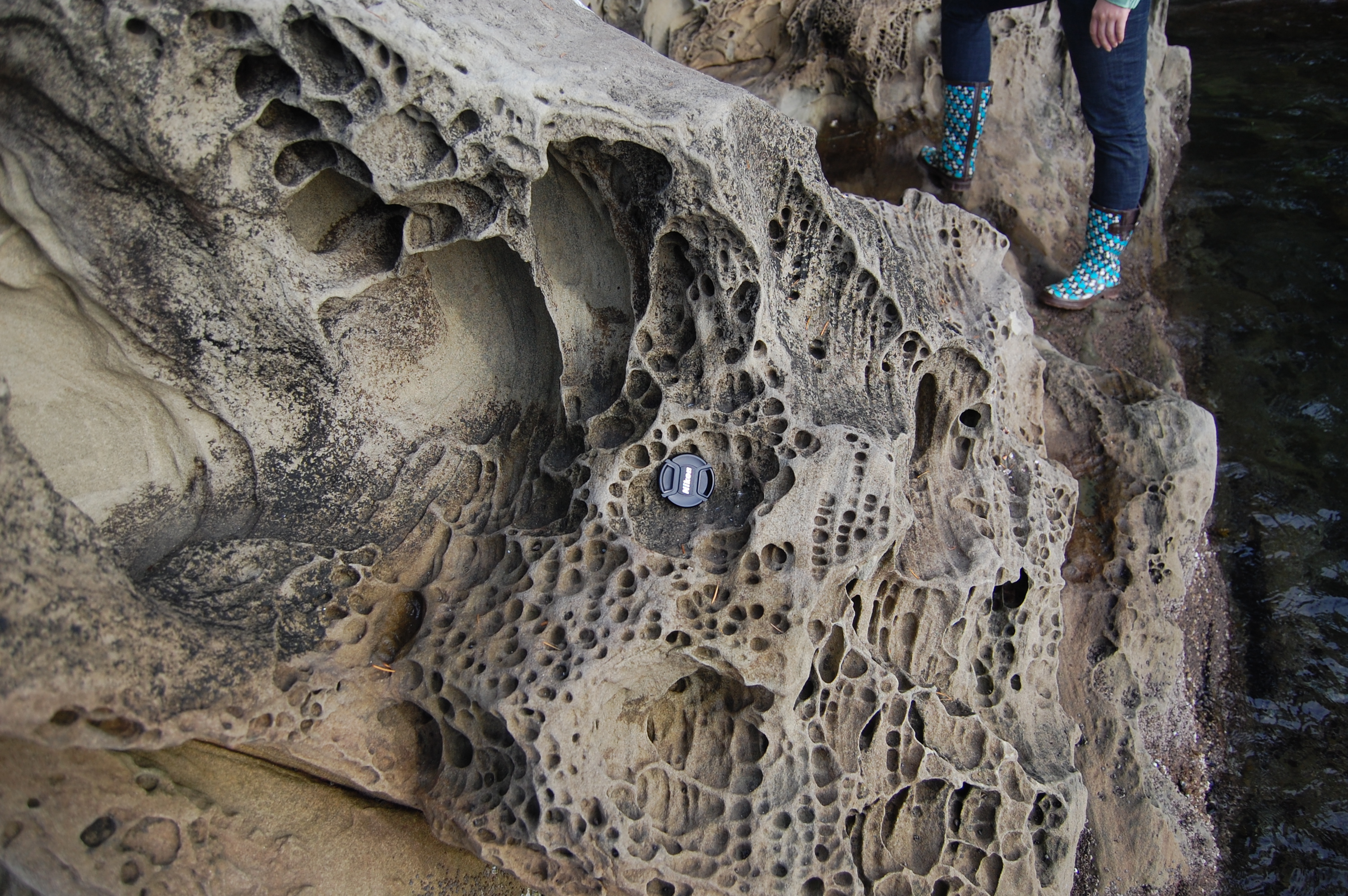 Photo: LizGeo310 (talk), CC BY 3.0, via Wikimedia Commons
Location and Directions
Chuckanut Drive (WA-11) leaves Interstate 5 at Burlington (south end) and rejoins it at Bellingham (north end). Larrabee State Park, the recommended pin and gateway to the drive, sits on Samish Bay roughly 7 miles south of downtown Bellingham at 245 Chuckanut Drive. Parking is paid (Washington State Parks Discover Pass required). The park has a paved entrance, beach access via stairs, picnic areas, and several trails inland.
For visitors planning to actually collect, the WA DNR Chuckanut Mountains area accessed from inland trailheads (Pine and Cedar Lakes, Lost Lake, the Rock Trail/Fragrance Lake network on DNR land) is the recommended target. The DNR Rockhounding page is the authoritative resource for which DNR parcels allow personal collecting. Inside Larrabee State Park itself, all collecting is prohibited.
Practical notes
A Discover Pass is required for vehicle parking inside Larrabee State Park. Tide tables matter for the shoreline ledges below the park's bluffs. Low tide widens the area visible to visitors and reduces wave splash on the lower bedding planes where the best plant impressions show. The Rock Trail in Larrabee climbs through standing Chuckanut sandstone cliffs and is the best in-park geological walk. The Clayton Beach Trail descends to a shoreline pocket beach also cut into Chuckanut bedrock. Bring water and footwear suitable for slippery, weathered sandstone.
What Fossils You'll Find
The Chuckanut Formation is Early Eocene, deposited about 55 to 50 million years ago in a low-relief river-and-floodplain system on the warm subtropical coastal plain that fringed the western edge of the proto-Cascade highlands. The formation locally exceeds 6,000 metres in cumulative thickness, one of the thickest non-marine Eocene successions in North America.
At Larrabee State Park (viewing only). Visitors are most likely to see compressed plant impressions on weathered shoreline ledges and in the standing cliff exposures along the Rock Trail. Fossil palm fronds (Sabalites) are the headline find. Well-preserved fronds 30 to 60 cm across appear on parted bedding planes. Hardwood leaves of sycamore-like Macginitiea, alder-related forms, beech-related forms, and a variety of other broadleaf taxa occur. Plant debris (coalified twigs, bark, root traces) is pervasive in the mudstones. In recent years, fossil-rich blocks have been mapped on the cliff face along the Rock Trail. The Washington Geological Survey publishes a poster, "Folds and Fossils of the Chuckanut Formation," highlighting these exposures.
In the broader Chuckanut Mountains DNR land (collecting permitted for plant fossils only). The same plant assemblage occurs across the DNR-managed mountains north and east of the state park. Sandstone outcrops in roadcuts and on hiking trails periodically yield plant material on freshly weathered surfaces. As at Racehorse Creek, vertebrate fossils (rare trackways of Gastornis, crocodile, turtle, and small mammals) are protected and may not be collected. The documented track material has been collected to the WWU Geology Museum and the Burke Museum under permit.
"The Eocene Chuckanut Formation consists of a phenomenally thick sequence of alluvial sandstone, conglomerate, mudstone, and coal, originally deposited in flood plains in subsiding basins near the coast of Washington." Northwest Geology Field Trips, summarizing the formation
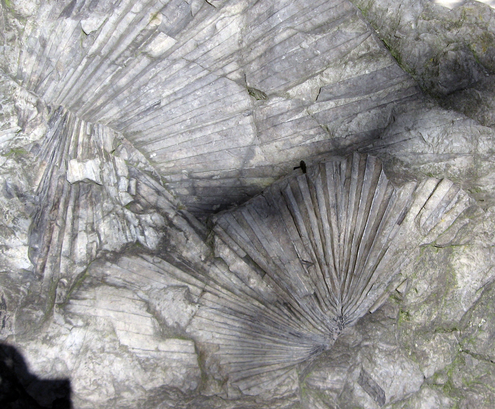 Photo: Kevmin, CC BY-SA 3.0, via Wikimedia Commons
Geologic History
In the Early Eocene the modern Pacific Northwest lay near 50° North in a globally hot greenhouse climate. The future Cascade mountain front had not yet risen. The modern Bellingham region was a broad coastal plain extending east toward newly uplifted highlands and west into a shallow embayment of the Pacific. Rivers draining the eastern highlands carried sand, mud, and plant debris west across this plain, building a thick fluvial-and-floodplain succession with abundant coal seams in the wetter low-relief portions. The Chuckanut Formation records this depositional system.
After Chuckanut deposition the entire succession was tilted, folded, and partly faulted during later Cascade tectonism. The local Chuckanut Mountains are an erosional remnant of this folded sedimentary stack, with bedrock dipping steeply (60° or more) along the western flank where it meets Samish Bay. The Quaternary glaciations have additionally scoured the modern shoreline and re-exposed the bedrock along Chuckanut Drive.
How Chuckanut Drive became a fossil destination
Larrabee State Park was Washington's first state park, established in 1915 on land donated by the Larrabee family. The Chuckanut Formation has been collected for fossils since the late 19th century. F. H. Knowlton's early-1900s monographs on Eocene plant fossils of the Pacific Northwest drew partly from this region. Modern detailed paleontology has been led by WWU geologist George Mustoe and the Burke Museum's paleobotany staff, with the 2009 Gastornis trackway discovery at Racehorse Creek bringing fresh national attention. The WA100 program highlights the Chuckanut Mountains as one of Washington's 100 geological destinations.
Collecting Rules & Regulations
Is Fossil Collecting Allowed?
At Larrabee State Park: no, viewing only under Washington State Parks rules. In the broader WA DNR-managed Chuckanut Mountains: yes for plant fossils, no for vertebrate fossils, in accordance with the WA DNR Rockhounding policy.
Key Points:
- Larrabee State Park: viewing only. A Discover Pass is required for vehicle parking. Disturbing or removing fossils, rocks, or natural features is prohibited under Washington State Parks rules.
- WA DNR Chuckanut Mountains: personal plant-fossil collecting permitted under the WA DNR Rockhounding policy. Vertebrate fossils require a scientific permit.
- On the DNR land where collecting is permitted, hand tools only. No power equipment.
- The shoreline below the cliffs is unstable. Do not climb the cliffs themselves and do not work directly below an overhang.
- For collecting trips, target DNR-managed land. For visitor experience and interpretation, target Larrabee.
Sources
Nearby sites
 Racehorse Creek Chuckanut Fossil Fields Hunting GuideFossil palm fronds (Sabalites), Tree fern fronds (Cyathea pinnata)
 Fort Ward Park (Blakeley Formation) Fossil Hunting GuideMarine mollusks, Crab concretions
 Alki Beach Blakeley Formation Fossil Hunting GuideMarine mollusks, Crab concretions
 Ginkgo Petrified Forest State Park Fossil Hunting GuidePetrified wood (Ginkgo), Petrified wood (50+ species)