Ambridge Fossil Hunting Guide
Image: James St. John (CC BY 2.0)
A roadcut along PA Route 51 near Ambridge exposes the Glenshaw Formation (Conemaugh Group), dating to roughly 299 to 300 mya. The lower Mahoning Shale preserves Carboniferous coal-forest plants, including Pecopteris seed ferns, Calamites horsetails, and Lepidodendron bark. The overlying Brush Creek Marine Zone contains gastropods and straight-shelled nautiloids.
By Edward Chen · Updated 27 July 2026
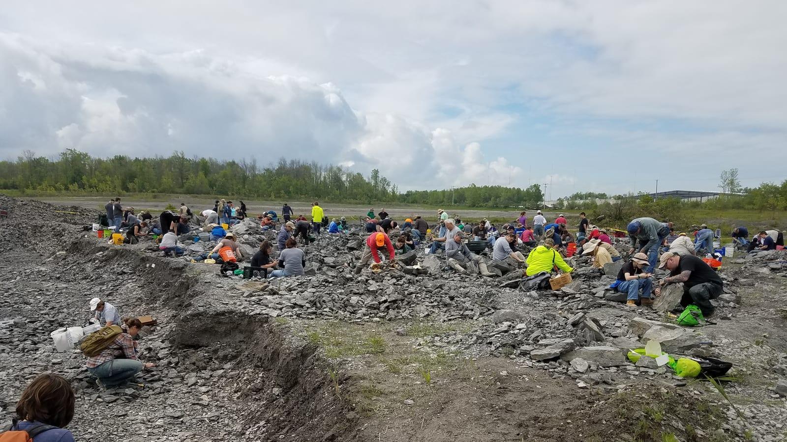
The Ambridge fossil site is a large roadcut along PA Route 51 in Beaver County, western Pennsylvania, about 20 miles northwest of Pittsburgh. The cut exposes the lower part of the Glenshaw Formation (Conemaugh Group), dating to roughly 299 to 300 million years ago in the Late Pennsylvanian (Late Carboniferous). Two distinct fossil zones are present: the Mahoning Shale at road level, which preserves coal-forest plant fossils, and the Brush Creek Marine Zone above it, which contains gastropods, straight-shelled nautiloids, and other marine invertebrates.
The shale splits easily with simple hand tools, and plant fossils are common enough that it is hard to leave empty-handed. The site is free to access and does not require a permit.
Location and Directions
The roadcut is on the west (Aliquippa) side of the Ohio River, directly across from the town of Ambridge. It runs along the southwest side of PA Route 51, adjacent to the Ambridge-Woodlawn Bridge. The cliff face is visible from the bridge itself.
Route 51 is a four-lane highway at this point, but the collecting area is separated from traffic by a Jersey barrier. Once inside the barrier zone, traffic is not a direct concern.
Parking is the main challenge. Route 51 has narrow lanes and no usable shoulder inside the barriers. The safest approach is to travel south from Aliquippa on Route 51, pass the bridge, and follow along the Jersey barrier until the road narrows to a single lane. About 100 yards past the end of the barriers, a gated dirt road appears on the right. Pull into this road and park to the right without blocking the gate. From there, walk back to the barrier-enclosed section. This puts you at the southern end of the exposure, which extends several miles northwest toward Aliquippa.
Do not park on the shoulder of Route 51 itself.
What Fossils You’ll Find
Mahoning Shale: Coal-Forest Plants
The lower level at road grade exposes shale from the Mahoning coal horizon, preserving the floor of a Carboniferous coal forest. Pecopteris seed fern fronds are by far the most common fossil. They split out of the dark shale in large, well-defined sections and are easy to identify by their rounded leaflets arranged along a central stem.
Calamites stem fragments are the next most common find. Calamites were giant horsetails that grew up to 20 m tall in the coal swamps. The fossilized stems show a ribbed, segmented pattern that is easy to recognize even in small pieces.
Neuropteris (and the closely related Macroneuropteris) seed fern fronds also turn up regularly, though less often than Pecopteris. They can be distinguished from Pecopteris by their broader, more rounded leaflets with a distinct midrib.
Sphenophyllum is a small, scrambling plant with wedge-shaped leaves arranged in whorls. Collectors sometimes confuse it with Annularia, the leaf clusters from Calamites trees, but Annularia has more than eight leaves per cluster and narrower individual leaves.
Lepidodendron bark impressions also appear in the shale. These giant lycopsid (scale) trees grew up to 30 m tall. Their bark left a pattern of diamond-shaped leaf scars that is one of the most recognizable Carboniferous fossils.
Large fossil plates containing multiple plant types are possible. The shale tends to shatter when it falls from the cliff, so check fallen slabs in the talus carefully before splitting fresh material.
Brush Creek Marine Zone: Invertebrates
Above the Mahoning plant-bearing shale lies the Brush Creek Marine Zone, composed of black, oily shales and limestones. This layer formed during a marine transgression, when rising sea levels flooded the lowland coal forests and replaced them with a shallow marine environment.
The Brush Creek Zone contains gastropods (snails), pelecypods (clams), solitary horn corals, and straight-shelled nautiloids. Small teeth from placoderms and primitive sharks have been reported from the broader region, though confirmed finds at this particular roadcut are rare.
Geologic History
During the Late Pennsylvanian, roughly 300 million years ago, Pennsylvania was positioned about 5 degrees south of the equator on the supercontinent Pangea. The newly formed Appalachian Mountains, then as tall as the modern Himalayas, ran through the eastern part of the state. West of the mountains, broad alluvial flood plains and swampy lowlands stretched toward the coast of the Panthalassic Ocean.
The climate was tropical and humid with little seasonal variation. High atmospheric carbon dioxide levels promoted dense plant growth. The swamp forests contained no flowering plants. Instead, they were dominated by giant lycopsid trees (Lepidodendron, Sigillaria), tree ferns, seed ferns (Pecopteris, Neuropteris), and giant horsetails (Calamites). Some lycopsid trees reached 30 m in height.
Insects in these forests included dragonflies with wingspans up to 75 cm, cockroaches reaching 10 cm, and various millipedes and scorpions. The earliest reptiles, such as Hylonomus, had already evolved the amniotic egg, allowing reproduction on land. Large amphibians also lived in the swamps, and fossilized jaw fragments from these animals have been found in the broader Ambridge area.
The Glenshaw Formation records repeated cycles of marine transgression and regression driven by glaciation events in the southern part of Pangea. When glaciers advanced, sea levels dropped and coal forests grew on the exposed lowlands. When glaciers melted, the Panthalassic Ocean flooded the forests, burying the plant material under marine sediments. Each cycle produced a sequence of coal, shale, and limestone. The stratigraphic column of the Conemaugh Group shows these cycles clearly as alternating bands of black coal beds, blue-grey marine limestones, and yellow channel sandstones.
At the Ambridge roadcut, one complete cycle is visible. The Mahoning coal and its associated plant-fossil shale sit at road level. The Brush Creek Marine Zone limestone and its marine invertebrate fossils lie directly above. This sequence records a single flooding event that transformed a coal swamp into a shallow sea.
Collecting Rules and Regulations
The roadcut is on public road right-of-way and collecting is free. No permits or fees are required. There are no posted restrictions on the amount of material you can take.
However, some roadcuts in the Pittsburgh area border private property. Always verify that you are on the public side of the right-of-way before collecting. If in doubt, check with local fossil clubs or the Pennsylvania Department of Transportation.
Tools and Tips
You do not need heavy equipment at this site. A flat-blade screwdriver is the most effective tool for splitting the soft Mahoning Shale along its bedding planes. A small pry bar (about 60 cm long) helps separate larger slabs. A rock hammer works but is not necessary for most of the shale.
Bring aluminum foil or thin foam sheets to wrap fragile fern fronds, and a small bottle of glue for quick on-site repairs if a fossil plate cracks along the edge. Insect repellent is recommended in warmer months, as the area has dense vegetation and ticks are common.
Do not climb the cliff face. The overall height of the roadcut is roughly 30 m with several bench levels carved into the cliff. Rocks fall regularly. Collect from the talus slopes at the base, where fallen material accumulates. The talus provides more than enough rock to keep a collector busy for several hours without the need to approach the cliff itself.
Wear safety glasses any time you are splitting rock. Shale fragments are thin and sharp.
Other Collecting Locations Near Pittsburgh
The Ambridge roadcut is just one of many Glenshaw Formation exposures in the greater Pittsburgh area. Most roadcuts around the city contain part of the Conemaugh Group, which means they have either Carboniferous plant fossils, marine invertebrates, or both. Some cuts also expose Permian-age rocks. Search for roadcuts with wide shoulders and low cliff faces where collecting is safe and legal.
Safety
This is a roadcut on an active highway, and traffic is by a wide margin the biggest risk here. Everything else is secondary.
PA Route 51 is fast and busy. Park well clear of the carriageway in a genuine pull-off, never on the shoulder of a bend or anywhere your vehicle is hidden from approaching drivers. Wear high-visibility clothing, work facing oncoming traffic where you can, and keep children within arm's reach at all times. Do not step into the roadway to look at anything, and do not let anyone in your group cross without checking. If there is no safe place to stop, drive on rather than improvising one.
The cut face is unstable. Road cuts through shale and sandstone are freshly exposed and shed rock, which is exactly why loose material accumulates at the base. Work that talus rather than the face. Do not climb, do not undercut, and do not stand beneath an overhang. A hard hat is sensible if you intend to spend time close to the rock, and eye protection is essential if you are striking anything.
The slope at the base is loose and uneven, so wear boots with a firm sole. Drainage ditches at the foot of a cut hold water and hide holes.
Western Pennsylvania has ticks in the vegetation along the verge through the warmer months, and poison ivy is common on disturbed ground. Long trousers deal with both. There is no shade at a roadcut, so carry water in summer.
Sources
- https://www.fossilguy.com/sites/ambridge/index.htm
- https://www.fossilguy.com/sites/ambridge/fern-fossils.htm
- https://www.fossilguy.com/sites/ambridge/marine-fossils.htm
- https://www.nautiloid.net/fossils/sites/ambridge/ambridge.html
- https://en.wikipedia.org/wiki/Glenshaw_Formation
- https://en.wikipedia.org/wiki/Conemaugh_Group