Black Mesa Triassic-Jurassic Fossil Guide
Image: Christopher Gabbard (CC BY-SA 2.0)
Black Mesa, in the far northwest corner of the Oklahoma panhandle near Kenton, exposes Triassic and Jurassic rocks that have yielded tons of dinosaur bones, including sauropods and stegosaurs, plus theropod trackways in nearby creek beds. The bones are studied at the Sam Noble Museum and the dinosaur sites are protected, so the area is for hiking and viewing rather than collecting.
By Edward Chen · Updated 3 August 2026
Introduction
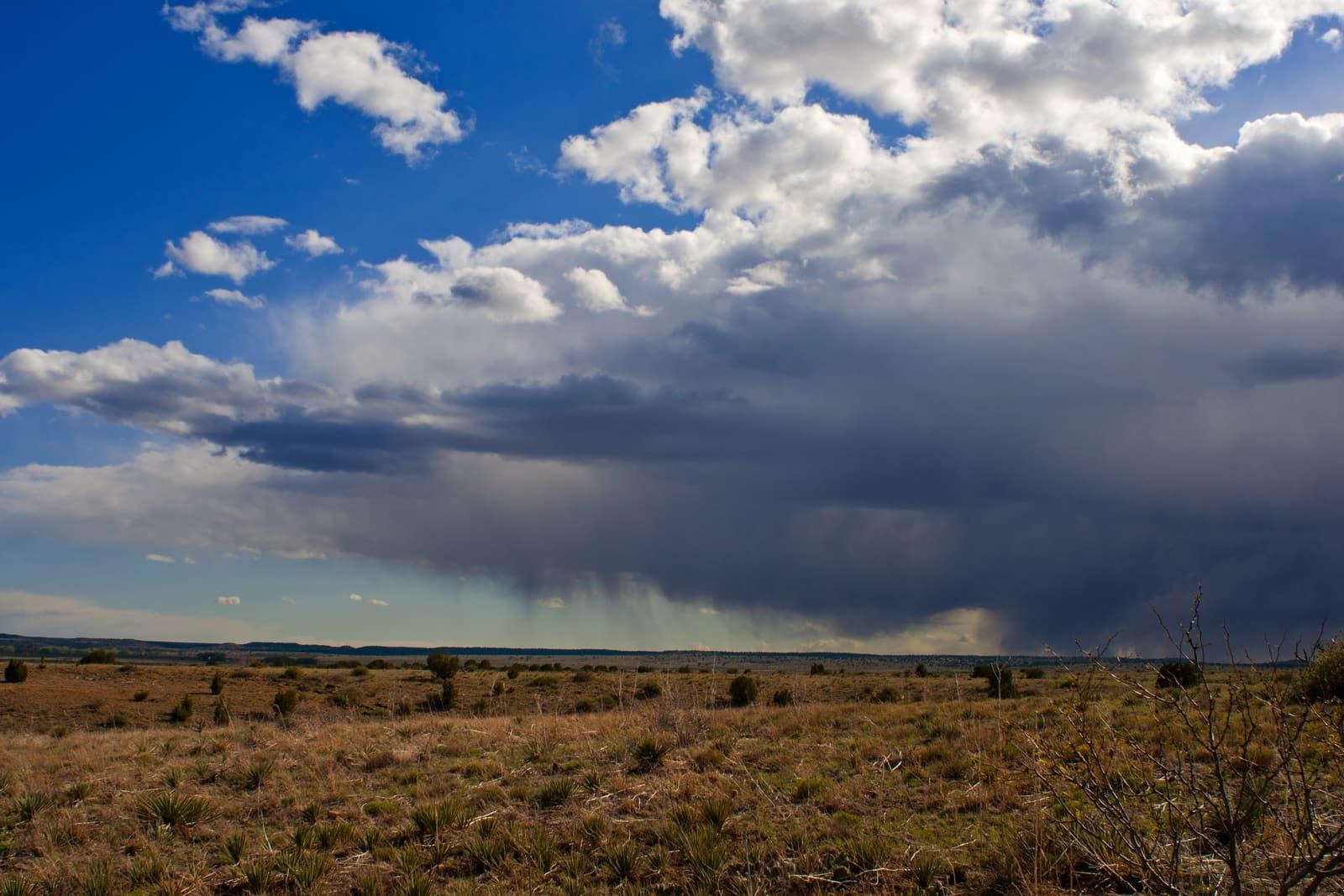
Black Mesa is the high, flat-topped lava-capped ridge in the far northwest corner of the Oklahoma panhandle, rising to 4,973 feet, the highest point in the state. Below the dark basalt cap, the slopes expose Triassic and Jurassic sedimentary rocks that have made the Kenton area one of Oklahoma's most important dinosaur regions. Since the 1930s, paleontologists have pulled tons of Jurassic dinosaur bone from these beds, and theropod footprints are preserved in creek beds nearby.
Between 1935 and 1942, geologist J. Willis Stovall led Works Progress Administration excavations here that recovered more than eighteen tons of dinosaur bone, including sauropods and plated stegosaurs. Those fossils are now curated at the Sam Noble Oklahoma Museum of Natural History at the University of Oklahoma in Norman. The dinosaur localities are scientifically managed and largely on protected or private land, so Black Mesa is a place to hike, see the geology, and visit the trackways rather than to collect vertebrate fossils.
Location and Directions
Black Mesa lies in northwestern Cimarron County near the tiny community of Kenton, close to the point where Oklahoma, Colorado, and New Mexico meet, near 36.90°N, 102.96°W. The mesa stretches in from Colorado and New Mexico and ends along the north bank of the Cimarron River. Black Mesa State Park, with a lake and campground, sits a few miles southeast, and the Black Mesa Nature Preserve protects the summit area, reached by a long hiking trail.
This is remote, high-plains country with few services, so come prepared with a full tank of fuel, plenty of water, and a paper map, since cell coverage is poor. The summit hike is long and exposed. A theropod dinosaur trackway is known from Carrizo Creek north of the mesa. Respect all fences and signs. Much of the surrounding land is private ranchland, and access to specific dinosaur sites is controlled.
 Photo: Chris M, CC BY 2.0, via Wikimedia Commons

 Photo: Carpenter, Kenneth, CC BY-SA 4.0, via Wikimedia Commons

What Fossils You'll Find
The Jurassic Morrison Formation here has produced the classic Late Jurassic dinosaur fauna, including long-necked sauropods such as the diplodocids, plated stegosaurs, and plant-eating ornithopods, along with the bones of meat-eating theropods. Petrified wood and other plant material occur in the same beds, and the older Triassic strata lower in the section add to the area's fossil record. Three-toed theropod footprints, pressed into Jurassic mud roughly 150 million years ago, are preserved in nearby creek exposures.
For a visitor, the fossils to experience are the dinosaur trackways in place and the excavated skeletons on display at the Sam Noble Museum. Loose bone scraps still weather out on the slopes, but vertebrate fossils here are protected and not for collecting.
Geologic History
The rocks of Black Mesa record a long span of the Mesozoic. In the Late Jurassic, around 155 to 148 million years ago, the region was a broad, seasonally dry floodplain crossed by rivers and dotted with lakes, the setting recorded by the Morrison Formation across much of the American West. Dinosaurs lived and died on these floodplains, and their bones were buried in river sands and muds. Older Triassic beds beneath the Morrison preserve a still earlier chapter of the same basin.
Much later, around two to five million years ago, basaltic lava flows spread across the area and capped the softer sedimentary rocks. Because the hard basalt resists erosion, it protected the rocks beneath it while the surrounding landscape wore down, leaving Black Mesa standing high above the plains as an inverted, lava-capped ridge. Continued erosion of the slopes keeps exposing the fossil-bearing Triassic and Jurassic layers.
Collecting Rules and Regulations
Black Mesa is not a place for collecting dinosaur fossils. Vertebrate fossils on federal and state land are protected by law and may be collected only by qualified researchers under permit, and the dinosaur quarries and trackways here are managed scientific sites. The Black Mesa Nature Preserve and Black Mesa State Park protect their natural features, so do not remove rocks, bones, petrified wood, or other materials from these lands. Most of the surrounding country is private ranchland, where you need the owner's permission to enter, let alone collect. Treat the dinosaur tracks as something to view and photograph in place, stay on trails, pack out everything you bring, and report significant fossil finds to a museum or the Oklahoma Geological Survey rather than digging them up.
Safety
This is rugged, remote high-desert terrain with extreme isolation, so tell someone your plans and carry far more water than you think you need. Summers are hot and the summit trail is long, exposed, and rocky, while winters can bring snow and bitter wind. Watch for rattlesnakes among the rocks, wear sturdy boots and sun protection, and start hikes early to avoid afternoon heat and thunderstorms. The mesa edges and basalt rimrock are steep and crumbly, so stay back from the rim. Because services and cell signal are scarce, plan for self-rescue and do not rely on a phone.
Sources
https://en.wikipedia.org/wiki/Black_Mesa_(Oklahoma,_Colorado,_New_Mexico) https://www.americasstateparks.org/state-park/black-mesa/ https://en.wikipedia.org/wiki/Morrison_Formation https://scholars.okstate.edu/en/publications/the-stratigraphic-position-of-a-dinosaur-quarry-at-black-mesa-ken/
Nearby sites
 Garden Park Fossil Area Fossil Hunting GuideAllosaurus fragilis (type), Stegosaurus stenops (type)
 Monument Rocks (Chalk Pyramids) Fossil GuideMosasaurs, Giant clams (Inoceramus)
 Florissant Fossil Beds National Monument Fossil Hunting GuideInsects, Plant leaves
 Florissant Fossil Quarry Fossil Hunting GuidePlants, Insects