
Stansgate Essex London Clay Fossil Hunting Guide
Image: Roger Jones (CC BY-SA 2.0)
Stansgate on the River Blackwater in Essex exposes Eocene London Clay with phosphatic nodules containing lobsters, crabs, shark teeth, and fish remains on a free foreshore.
By Edward Chen · Published 27 April 2026
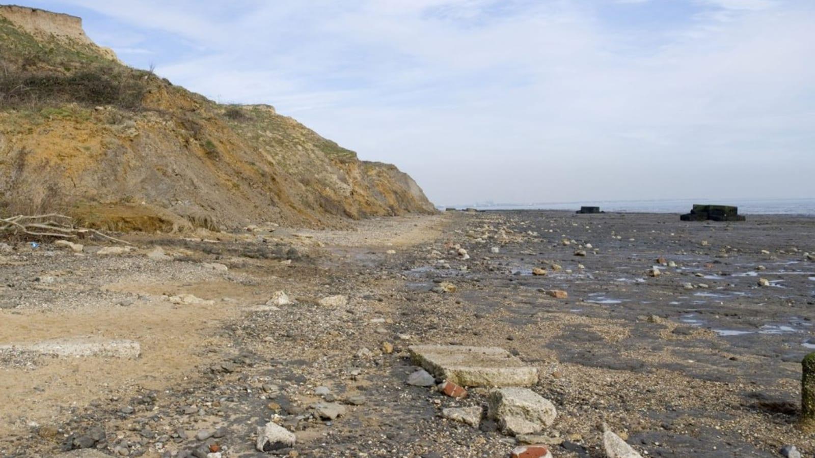
The foreshore along the south bank of the River Blackwater at Stansgate, east of Maylandsea and Steeple in Essex, exposes London Clay of Eocene age, laid down approximately 50 million years ago in a warm subtropical sea that then covered much of southern England. Like the better-known London Clay sites at Maylandsea and Burnham-on-Crouch further east, the Stansgate foreshore yields phosphatic nodules containing the remains of crustaceans including lobsters and crabs, along with shark teeth and fish remains eroding loose from the clay into the overlying shingle. The site is less visited than its near neighbours, which means competition for finds is lower, but the nodule density is also somewhat reduced, requiring more systematic searching to locate productive patches of shingle.
This is a foreshore site entirely dependent on the tide for access. You need to plan your visit around low water, check the relevant tide tables, and be back on higher ground before the tide returns. This guide covers the approach, what to look for, the Eocene geology, and the rules for collecting on this stretch of the Essex coast.
 Photo: Roger Jones, CC BY-SA 2.0, via Wikimedia Commons
Location and Directions
Address
Foreshore along the south side of the River Blackwater, east of Steeple, Essex. The site is reached from the Stansgate area of the Dengie peninsula.
Directions and Parking
From Chelmsford, take the A414 east toward Maldon, then continue south on the B1018 and minor roads toward Steeple village. From Steeple, follow minor roads toward Stansgate. Parking is limited to roadside areas near the coastal access points. Do not block farm gates or private driveways. The foreshore is accessed via a public footpath leading to the sea wall, from which you descend to the foreshore. GeoEssex (geoessex.org.uk) provides specific route guidance for the River Blackwater London Clay sites and is worth consulting before your visit. The drive from Chelmsford takes approximately 45 to 50 minutes. Check tide times for Mersea Island or Bradwell, which are the nearest tidal reference points for the Blackwater estuary.
What Fossils You'll Find
Phosphatic nodules are the key to finding the best Stansgate fossils. These dark brown to black, irregular lumps of phosphatised sediment form concentrations in the upper foreshore shingle where the clay has eroded and been reworked by wave and tidal action. Inside the nodules, preserved in three dimensions, you may find lobster claws and carapace segments, crab remains, fish bones, and occasionally plant material. The nodules can range from grape-sized to fist-sized. Examine each one carefully before discarding it: the fossil content may not be immediately apparent from the exterior. Splitting nodules with a geological hammer sometimes reveals intact crustacean remains inside.
 Photo: JYB Devot, CC BY-SA 4.0, via Wikimedia Commons
Shark teeth are found loose in the shingle and in the intertidal zone where the clay surface is exposed. Eocene shark species from the London Clay include Striatolamia and Otodus obliquus, among others. The teeth are typically small (1 to 3 cm), dark brown or black due to mineralisation, with a smooth enamel face. Work systematically through shingle patches, sifting through the finer gravel with your fingers, to locate them.
Fish remains including vertebrae, otoliths (ear stones), and fin spines occur in the same shingle concentrations as the shark teeth. Vertebrae are recognisable by their biconcave disc shape and are occasionally found in short articulated sequences within a nodule. Otoliths are smooth, oval stones with a distinctive internal groove pattern and occur in both loose form and within nodules.
Crustaceans (lobsters and crabs) are the flagship finds of the London Clay sites and occur at Stansgate, though the density is lower here than at Maylandsea. The claws and carapace plates of lobsters such as Hoploparia are the most frequently encountered parts, as the fragile bodies rarely survive transport intact.
Geologic History
The Ancient Environment
The London Clay Formation at Stansgate was deposited during the Ypresian Stage of the Early Eocene, approximately 54 to 50 million years ago. At this time, the climate was significantly warmer than today, and the global temperature was close to or at the Early Eocene Climatic Optimum, one of the warmest sustained intervals of the past 66 million years. The sea covering Essex was subtropical in character, with surface temperatures perhaps 10 to 12 degrees Celsius warmer than the modern North Sea. The water was approximately 100 to 200 metres deep, warmer and more stratified than today, and the seafloor was an oxygen-poor muddy environment where organic matter was preserved rather than decomposed. The sharks, fish, lobsters, crabs, and other organisms that died and sank to this seafloor were sometimes buried rapidly in the reducing conditions of the seafloor mud, where phosphatisation of the remains could occur within the nodules. The nearest land during London Clay time was in the Midlands, and rivers carrying plant material from forested subtropical coasts introduced seeds and organic debris into the marine environment. The phosphatic nodules form a lag deposit: after the clay was deposited, erosion by the sea removed the fine sediment and concentrated the more resistant nodules in a residual layer at the surface of the clay exposure.
How Stansgate Became a Fossil Collecting Site
The London Clay of Essex has been exposed along the River Blackwater and its tributaries by post-glacial sea level rise and subsequent coastal and estuarine erosion over the past 10,000 years. At Stansgate, the clay bank is cut by tidal action, which removes the soft clay and leaves a concentration of erosion-resistant phosphatic nodules and their enclosed fossils in the intertidal shingle. This is a slow and ongoing process, and each tidal cycle exposes new material at the base of the clay face and redistributes existing material along the foreshore. The site is one of a chain of London Clay exposures along the south side of the Blackwater estuary, each with slightly different characteristics depending on the local clay facies and the rate of erosion.
Collecting Rules and Regulations
Is Fossil Collecting Allowed?
The foreshore at Stansgate is publicly accessible tidal land. Surface collection of loose material from the shingle and foreshore is permitted under standard foreshore rights in England. You should not excavate into the clay bank itself or remove large volumes of nodule-bearing shingle in a way that could deprive the site of material. The foreshore is managed as part of the wider Essex coast and is subject to standard bylaws relating to coastal access. Essex Wildlife Trust manages several nature reserves in the Blackwater area, and it is worth checking their website for any access restrictions specific to the stretch of foreshore you intend to visit.
Recommended Tools
A geological hammer for splitting nodules is the most useful piece of equipment. A small trowel or hand fork helps when sifting through shingle to locate shark teeth and nodule concentrations. Bring a sieve if you want to process finer material more efficiently. Waterproof boots are essential as the foreshore is muddy and often waterlogged at the clay surface. Padded wrapping for crustacean material is important, as lobster and crab remains can be fragile.
Safety
The primary hazard at Stansgate is the tide. The Blackwater estuary fills and empties rapidly, and the foreshore can be cut off if you misjudge the tide. Check times for Mersea Island or Bradwell before setting out and allow yourself a generous safety margin. The clay surface below the shingle is extremely slippery. Take care when moving between areas of firmer ground. The Dengie peninsula is a remote rural area with limited mobile coverage in places, so make sure your phone is fully charged and that someone knows your planned itinerary.


