Ladonia Fossil Park (North Sulphur River) Guide
Image: The Fossil Forum (Used with attribution)
The Ladonia Fossil Park on the North Sulphur River in Fannin County, Texas, is the formal public-access entry point to one of the Southwest's most productive Late Cretaceous fossil rivers. Channelised decades ago for flood control, the river now continuously erodes Maastrichtian-aged Ozan and Pecan Gap chalk, washing mosasaur teeth, shark teeth, ammonites, and Pleistocene mammal bones onto the gravel bars. Free public collecting.
By Edward Chen · Published 30 May 2026
The North Sulphur River cuts a steep, sinuous channel across the rolling plains of northeast Texas, exposing Late Cretaceous (Campanian–Maastrichtian) chalk and marl of the Taylor and Navarro groups. Channelised in the 1920s for flood control, the river has aggressively downcut since, exposing a fresh fossil-bearing section every year. It is one of the Southwest's most legendary public fossil rivers, collectors routinely find mosasaur teeth, ammonite fragments, abundant shark teeth, and Pleistocene mammoth, Bison antiquus, and giant ground-sloth bones reworked into the river gravel.
The City of Ladonia, in partnership with the Upper Trinity Regional Water District, operates the Ladonia Fossil Park as the formal public access. The park has a parking lot, covered pavilion, picnic tables, and a paved path down to the river. Construction of the upstream Lake Ralph Hall reservoir has changed access on the river's upper reaches. The Fossil Park remains open during the work.
Location and Directions
Ladonia is in Fannin County, northeast Texas, about 90 miles northeast of Dallas.
Directions to Ladonia Fossil Park
From Dallas, take I-30 east to US-69 / SH-34 north to Ladonia, then follow FM 904 east of town to the park at 2242 FM 904. The park is open dawn to dusk except in inclement weather. There is no fee.
Bring rubber boots or river shoes (you'll be wading), a small bucket or zip-top bags, a hand sieve, sun protection, water, and insect repellent. Best collecting is after a rain event has scoured fresh material from the banks. Avoid the river during or directly after major storms when banks are unstable and currents are dangerous. No motorised vehicles or ATVs (including electric vehicles) are allowed on the riverbed.
Access upstream of the Fossil Park (toward the Leon Hurse Dam and the mitigation area for Lake Ralph Hall) is now closed. Collectors should stay between the park and the downstream public-access points.
What Fossils You'll Find
The Ozan, Pecan Gap, and overlying Navarro Group sediments record the open marine waters of the Late Cretaceous Western Interior Seaway across what is now northeast Texas, from the Campanian Stage (about 84 million years ago) into the Maastrichtian (down to roughly 70 million years ago).
Shark teeth are the most abundant find at the Fossil Park. The scavenging shark Squalicorax kaupi leaves characteristically arched and finely serrated black teeth that are usually the first identifiable shark fossil a new collector picks up. The lemon-sized triangular teeth of Cretolamna appendiculata are also common, along with the slender, striated crowns of the goblin shark Scapanorhynchus texanus. The durophagous shark Ptychodus, which crushed thick-shelled prey with pavement-like teeth, leaves distinctive square-faced fossils with concentric ridges. Complete crushing plates are particularly prized. The larger blades of Cretodus crassidens and the occasional fragment of an Otodontid lineage shark round out the chondrichthyan assemblage.
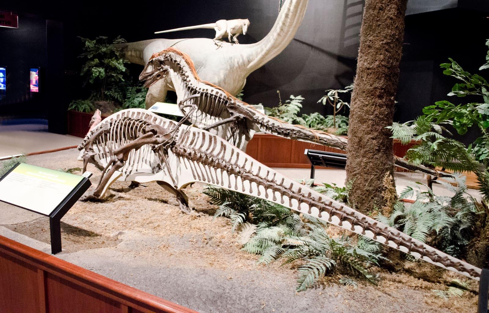
Mosasaur material is the headline draw. Teeth of Tylosaurus proriger and Tylosaurus nepaeolicus, both 10- to 12-metre apex predators, are recovered every season, recognisable by their broad, slightly bicarinate crowns. The smaller plioplatecarpine Platecarpus tympaniticus teeth are also routine finds. The shell-crushing globidensine Globidens alabamaensis contributes blunt, hemispherical teeth that look almost like polished black river pebbles. The youngest member of the family, Mosasaurus hoffmanni itself, occurs in the upper Navarro at the very top of the section. Partial mosasaur jaws and vertebrae turn up multiple times each year, and an notable number of mosasaur fossils have come out of the river over the decades.
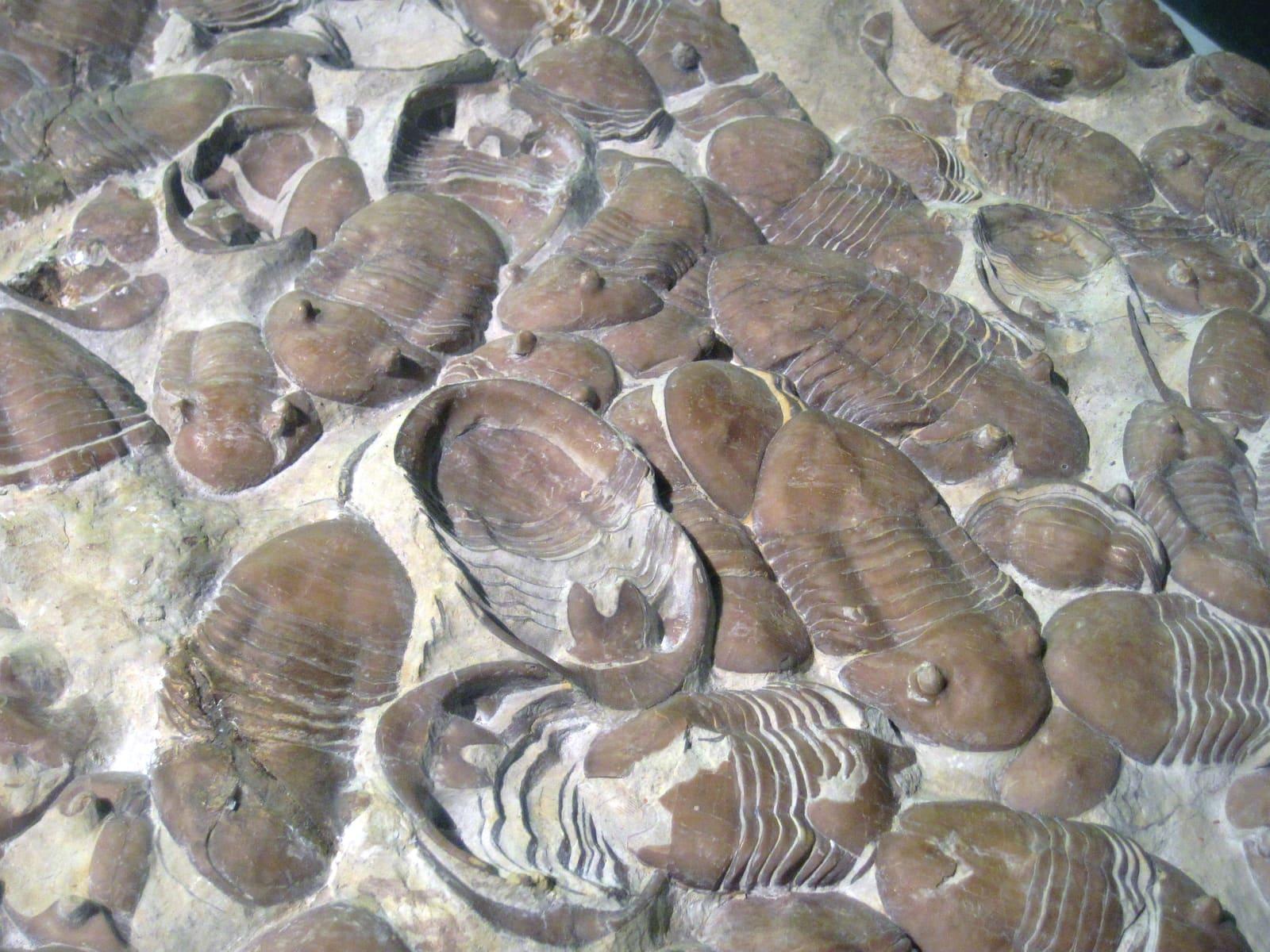
Ammonites include the disc-shaped Sphenodiscus pleurisepta, the straight-shelled biostratigraphic index Baculites compressus, the hook-shelled Discoscaphites and Hoploscaphites, and the heteromorph Didymoceras. Inoceramus shell prisms (the so-called "fish-scale rock") are abundant. Other invertebrates include the bivalves Exogyra costata and Pycnodonte, brachiopods, and crinoid columnals.
The river bed also yields reworked Pleistocene Ice Age material derived from the overlying Quaternary terraces. Columbian mammoth (Mammuthus columbi) molar plates and the occasional tusk fragment, Bison antiquus horn cores and limb elements, the giant ground sloth Eremotherium laurillardi (claws, teeth, dermal ossicles), Pleistocene horse (Equus) teeth, and smaller carnivore remains all turn up scrubbed clean by the modern North Sulphur. Whole specimens of any kind are rare but possible, partial mosasaur jaws, articulated ammonite halves, and even sections of mammoth tusk turn up multiple times each year.
"You can collect fossils for personal use when exposed in river gravels and banks." Ladonia Fossil Park (City of Ladonia)
Geologic History
During the Campanian and Maastrichtian, what is now northeast Texas lay near the shifting eastern shoreline of the Western Interior Seaway, where the seaway broadened toward its connection with the proto-Gulf of Mexico. Chalky carbonate muds, glauconitic clays, and minor sandstones accumulated in calm, often dysoxic conditions on a slowly subsiding shelf. The Taylor Group (which includes the Ozan and Pecan Gap formations) records mid- to late Campanian sedimentation, while the overlying Navarro Group spans the Maastrichtian. The K-Pg boundary itself is preserved in the uppermost Navarro Group in some sections of north and central Texas, though not at Ladonia. The fossils we find today represent the marine community of that disappearing sea, the mosasaurs, sharks, and ammonites at the top of the food web, plus the prolific Inoceramus and oyster benthic community.
Long after the Cretaceous ended, the Pleistocene ice ages draped fluvial gravels, mammoth-bearing sands, and overbank silts across much of north Texas. The pre-channelisation North Sulphur River meandered slowly across a low, gently sloping floodplain. In 1928, the river was straightened and confined to a single deep channel for flood-control and agricultural drainage purposes. The artificial channel cut down through the Holocene floodplain into the underlying Cretaceous bedrock within a few decades, producing a dramatic arroyo-like channel up to 12 metres deep in places. Aggressive subsequent downcutting and lateral bank failure have continuously refreshed the fossil exposures by erosion of both the Cretaceous bedrock and the reworked Pleistocene gravels, making the modern North Sulphur River an unusually productive accidental view of 80 million years of North Texas history.
The Upper Trinity Regional Water District began construction of the Lake Ralph Hall reservoir on the upper North Sulphur River drainage in the early 2020s. The reservoir will flood much of the upper river and the formerly-popular collecting area above the Leon Hurse Dam.
How Ladonia Fossil Park Came to Be
Local collectors have worked the North Sulphur River since at least the 1930s, and Dallas Paleontological Society field trips have visited the river for decades. As Lake Ralph Hall construction began closing the upper river, the Upper Trinity Regional Water District established the Ladonia Fossil Park around 2020 in partnership with the City of Ladonia, formalising the lower river as a managed public collecting site with parking, signage, and a covered pavilion. The park's location at the downstream end of the active erosion zone ensures continuing fossil supply even as the upper river is impounded.
Collecting Rules & Regulations
Is Fossil Collecting Allowed?
Yes, for invertebrate and reasonable-quantity vertebrate fossils for personal (non-commercial) use, with the exception that vertebrate fossils on federally administered lands and specimens of scientific interest may require reporting.
Key Points:
- Free public access dawn to dusk
- No motorised or electric vehicles on the river or park grounds
- Pack out everything you bring in
- Access upstream of the park (toward Leon Hurse Dam) is now closed
- Do not collect Native American artifacts
- River currents are dangerous during and after storms. Check the weather