Griffins Landing Giant Oyster Fossil Guide
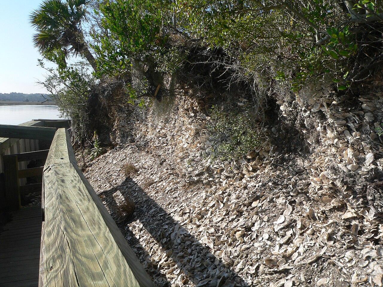
The type exposure of the Griffins Landing Member of the Dry Branch Formation, on the Savannah River in Burke County, Georgia. Late Eocene calcareous sand and shell beds with the giant oyster Crassostrea gigantissima. Entry needs a Georgia licence or Lands Pass.
By Edward Chen · Published 12 October 2026
Introduction
Griffins Landing is the type locality of a named rock unit. The United States Geological Survey lexicon records the Griffins Landing Member of the Dry Branch Formation. Its type section is here, on the Savannah River in Burke County, Georgia.
The description is precise. The exposure lies 2.25 km north of the junction of Griffins Landing Road and River Road, and 8.4 km north of Girard. Huddlestun and Hetrick named the unit in a 1979 Georgia Geologic Survey open-file report. They formalized it in Bulletin 95 in 1985. The type section is 19.1 m thick.
The rock is massive to rudely bedded fossiliferous calcareous sand, with limestone and shell beds and clay lenses. The age is late Eocene, in the Jacksonian of Gulf Coast usage.
The fossil that made the reach famous is an oyster the size of a forearm. In 1911 the Georgia Geological Survey recorded a specimen from Griffin Landing measuring 20 inches in length.
Read the access section before you plan anything. This land sits inside a Georgia wildlife management area. Entry needs a pass, collecting needs written permission, and the property is hunted.
Location and Directions
Griffins Landing is on the Georgia bank of the Savannah River, in the northeastern corner of Burke County. GPS: 33.1165°N, 81.6999°W.
Those coordinates are derived rather than published. The lexicon puts the type section 2.25 km north of where Griffins Landing Road meets River Road. That is 8.4 km north of Girard. Mapping both roads and the river channel puts that point on the Savannah River at the stated distance from both. Treat the figure as accurate to a few hundred meters along the bank.
Access runs through Yuchi Wildlife Management Area. The Georgia Department of Natural Resources describes Yuchi as about 7,800 acres in Burke County. The check station address is 780 Ebenezer Church Road, Waynesboro, GA 30830. The department gives its position as 33 deg 05 min 57 sec N, 81 deg 47 min 03 sec W. The department's own Yuchi map, revised in 2014, shows Griffins Landing Road running north from Georgia Highway 23 into the area. It also shows wildlife management area blocks fronting the Savannah River.
The area has a boat ramp at Brighams Landing, at the eastern end of the property. It also has canoe access, primitive campsites and a shooting range. A boat is the sane way to reach a river bluff.
Useful numbers from the department: Region 3 office on 706-595-4222, general enquiries on 706-557-3333, and the Ranger Hotline on 800-241-4113.
What Fossils You'll Find
The headline fossil is the giant oyster. Modern work calls it Crassostrea gigantissima, named by Finch in 1824 from Shell Bluff upstream. The Global Biodiversity Information Facility now treats Striostrea gigantissima as the accepted combination, so you will meet all three names in the literature. Older Georgia reports call it Ostrea georgiana Conrad.
A 2011 Geological Society of America abstract reports on Eocene strata exposed by excavations at Plant Vogtle, a few kilometers up the same reach. The authors are Ralph Willoughby, David Dockery, Timothy Glidden and Frank Syms. They describe the base of the Griffins Landing Member as a hard calcareous limestone. It contains Crassostrea gigantissima, other molluscs, acorn and scalpelloid barnacles and other fossils. Bioherms, which are mound-shaped buildups of organisms, occur in the quartz sand above that base.
The 1911 Georgia Geological Survey account of Griffin Landing is worth reading before a visit. It tells you what the beds look like in order. Veatch and Stephenson logged two oyster beds separated by a clay. The lower bed, 10 ft thick, holds large oysters in a pale greenish clay. The survey names Calyptraea aperta, Modiolus and Balanus alongside them. Balanus is a barnacle, which matches the 2011 report. Above it sits 5 ft of drab laminated clay. Then comes a further 10 ft of large oysters in greenish-gray argillaceous sand and drab clay, and about 100 ft of sand above that.
Practical advice follows from that log. The oysters are not scattered through the section. They sit in two beds, and everything above them is barren sand. Find the shell horizon first.
In the Shell Bluff vicinity the same 1911 report places the oyster bed 75 to 110 feet above the river. The productive rock is well up a bluff rather than at the waterline.
Geologic History
Late Eocene Georgia lay under a shallow, warm sea that reached far inland across the Coastal Plain. The Dry Branch Formation records that sea along the inner margin of the Atlantic Coast basin.
The Griffins Landing Member is the calcareous part of that record. The lexicon places it above the Clinchfield Formation and below the Tobacco Road Sand. It interfingers with the Twiggs Clay Member and the Irwinton Sand Member of the same formation. Huddlestun and Hetrick describe it as the thickest member of the Dry Branch Formation, thinning updip and making up more of the formation downdip.
Zullo and Kite extended the unit into Aiken County, South Carolina, in 1985, on the strength of two auger holes. They read its fauna as subtidal to inner shelf. That is the water depth to picture. Not a beach, and not a deep basin.
The International Commission on Stratigraphy places the Priabonian, the late Eocene stage, between 37.71 and 33.9 million years ago. That range is the basis for the age on this page.
A stratigraphic caution
The 1911 survey did not use the name Griffins Landing. Veatch and Stephenson assigned the oyster beds at Griffin Landing to the McBean formation. They treated a prominent oyster ledge between Shell Bluff and Griffin Landing as the top of that unit. The modern lexicon puts the Griffins Landing Member of the Dry Branch Formation at this spot. The 2011 abstract has it resting unconformably on an older unit informally called Utley.
So the 1911 oyster beds and the modern Griffins Landing Member may or may not be the same rock. Nobody should assume they are. If you are logging a section here, use the modern nomenclature and record what you actually see.
Collecting Rules and Regulations
You need two separate things to collect here. Treat them separately.
First, land access. The Georgia Department of Natural Resources states on its own Yuchi page that a hunting licence, a fishing licence or a Lands Pass gives land access to the area. Buy one at gooutdoorsgeorgia.com before you arrive. A Lands Pass is the option for a visitor who does not hunt or fish.
Second, permission to collect. A licence lets you walk the ground. It does not let you take rock or fossils. The department's own guidance on collecting states plainly that surface collecting, digging and metal detecting are not legal on state property, citing sections 12-3-10(n) and 12-3-52 of the Official Code of Georgia Annotated. That guidance is written around archaeological material rather than fossils, and I could find no published Georgia rule that grants a general right to collect fossils on a wildlife management area.
So the honest position is this. Assume you may not collect, and write to the Wildlife Resources Division before you go. The Region 3 office on 706-595-4222 is the place to start, and ask them to route the request to whoever issues written permission. Get the answer in writing and carry it.
Other rules that apply on every Georgia wildlife management area:
- Camping is allowed in designated sites only.
- Target practice is allowed only at a range the department provides.
- Driving around a closed gate, cable or sign is prohibited.
- Alcohol is prohibited outside houses and campsites.
- Check georgiawildlife.com/closures before you travel, because the department closes individual properties at short notice.
Safety
Yuchi is hunted. This is the first thing to plan around. The department lists deer, turkey and small game hunting across the property. During firearms and primitive weapons deer and bear seasons, Georgia rule 391-4-2-.04 requires every hunter and every person accompanying one to wear at least 500 square inches of daylight fluorescent orange above the waist. A fossil hunter is not legally covered by that rule, which is exactly why you should wear the orange anyway. Check the current season dates and any quota hunts before you choose a date.
River bluffs fail without warning. The productive beds sit high in a bluff above the Savannah River, and the 1911 survey already complained about talus covering parts of these exposures. Do not undercut a face, do not climb one, and keep well back from the top edge.
The Savannah River is a large river with current. If you approach by boat, wear a buoyancy aid and watch the water level. Boat ramp access on this property has been reported as rough.
Heat, insects and snakes. Burke County summers are hot and humid. Carry more water than you think you need. Ticks and chiggers are abundant, mosquitoes are constant near the river, and cottonmouths and rattlesnakes live in this habitat. Long trousers, boots and repellent are the baseline.
Tell someone your plan. This is a large, lightly used property with poor mobile coverage in places and a long drive to the nearest town.
A note on Shell Bluff, 11 miles upstream. It is the classic Georgia locality for the same oyster, and the 1911 survey logged over 100 feet of marl there. This guide does not cover it, and nothing here should be read as advice about reaching it.
Sources
https://ngmdb.usgs.gov/Geolex/Units/GriffinsLanding_1899.html https://ngmdb.usgs.gov/Geolex/UnitRefs/GriffinsLandingRefs_1899.html https://gsa.confex.com/gsa/2011SE/webprogram/Paper184335.html https://epd.georgia.gov/document/publication/b-26-preliminary-report-geology-coastal-plain-georgia-1911/download https://georgiawildlife.com/yuchi-wma https://georgiawildlife.com/sites/default/files/wrd/pdf/maps/Yuchi%20WMA%20Map.pdf https://georgiawildlife.com/sites/default/files/hpd/pdf/archaeology/FAQ_Collecting.pdf https://www.law.cornell.edu/regulations/georgia/Ga-Comp-R-Regs-R-391-4-2-.04 https://www.law.cornell.edu/regulations/georgia/Ga-Comp-R-Regs-R-391-4-2-.60 https://law.onecle.com/georgia/title-27/27-3-1.1.html https://www.gbif.org/species/9457777 https://doi.org/10.1017/s0022336000020679 https://stratigraphy.org/ICSchart/ChronostratChart2024-12.pdf