Lavini di Marco Fossil Hunting Guide
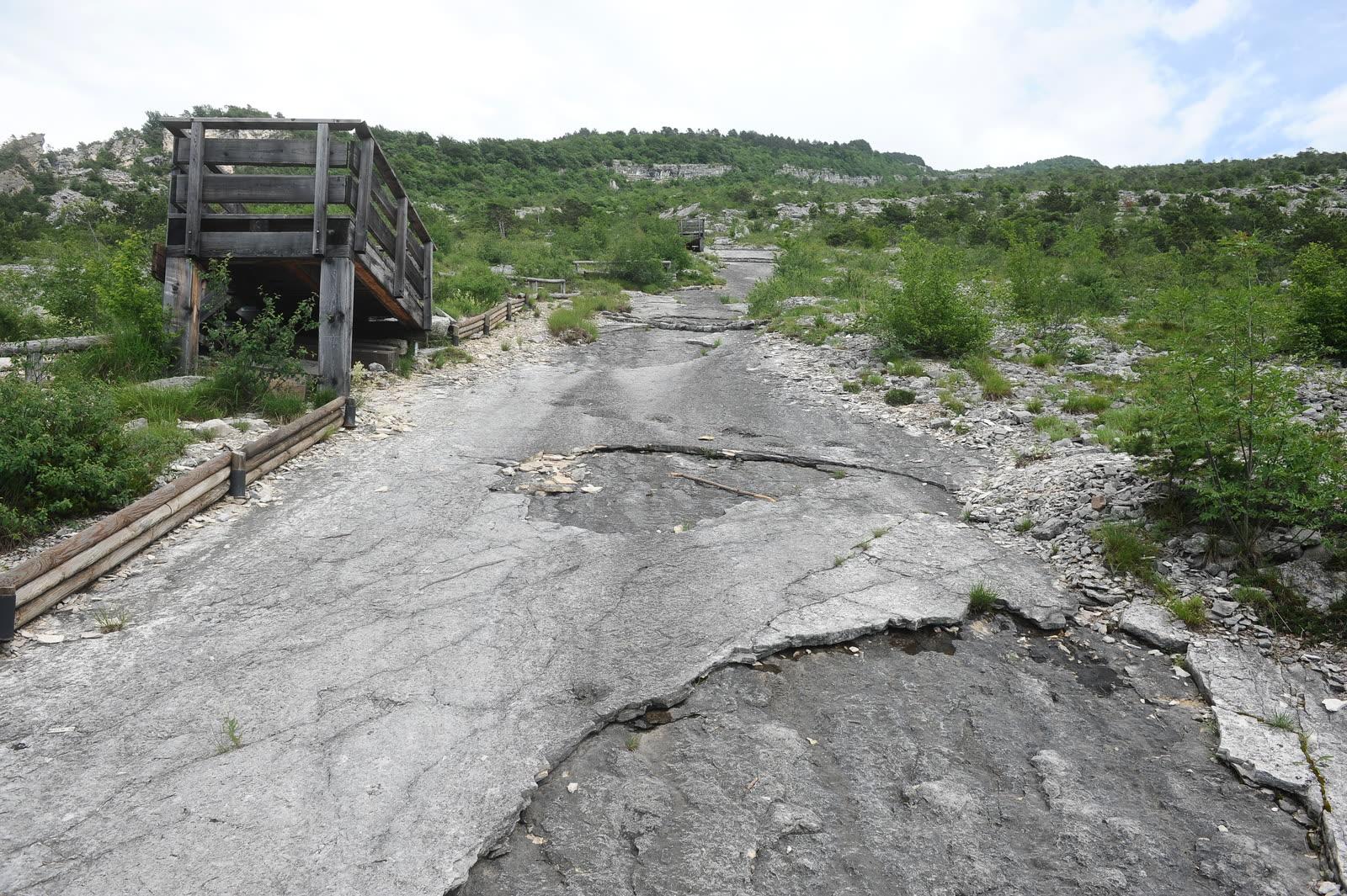
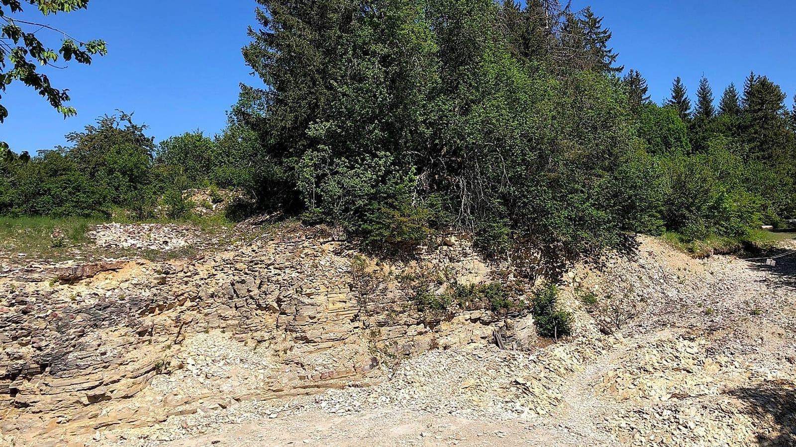
Image: Niccolò Caranti (CC BY-SA 4.0)
Lavini di Marco is a free dinosaur tracksite on the slopes of Monte Zugna near Rovereto, Trentino. Hundreds of Early Jurassic footprints and trackways lie on tilted limestone of the Monte Zugna Formation. Collecting is prohibited.
By Edward Chen · Published 1 October 2026
 Photo: Niccolò Caranti, CC BY-SA 4.0, via Wikimedia Commons

Introduction
Lavini di Marco is a dinosaur tracksite on the western slope of Monte Zugna, near Rovereto in Trentino. It lies about 30 km south of Trento. The tracks sit on tilted Early Jurassic limestone of the Monte Zugna Formation, part of the Calcari Grigi Group.
Luciano Chemini found the site in 1989. A 2025 survey by Sapienza University of Rome and the MUSE science museum in Trento recognized more than 700 tridactyl footprints. It also recognized nine narrow-gauge quadrupedal trackways. The Province of Trento reports more than 1,000 footprints in total.
Entry is free, and the trail is open all year. Two laws protect the tracks, so this is a viewing site. You look at the prints where they lie and you leave them alone.
The numbers differ between sources. Counts depend on what each team counted and when. This guide gives the source for each figure.
Location and Directions
The tracks lie at about 45.8553°N, 11.0173°E on the slope above Lizzana. The trailhead car park lies near the Grotta Damiano Chiesa cave at 45.8534°N, 11.0362°E. Visit Trentino describes the approach from the Castel Dante ossuary. Follow the Strada degli Artiglieri to the Baita degli Alpini parking area.
The Baita Alpini Damiano Chiesa parking sits at the end of the paved road. Large buses cannot reach it. Use a car or a small private bus.
From the car park, walk back along the road to the start of the dinosaur trail. Dolomiti.it gives the trail as 2.1 km long, with 30 m of ascent and a high point of 180 m. It rates the walk as grade T, which means tourist grade, and gives 30 minutes. The road is asphalt at first and then a dirt path.
Visit Trentino calls the terrain moderate hiking on a steep rock slab. The setting is dry and sunny, so take water in summer. Wear boots or sturdy trainers and carry a windbreaker or umbrella.
The 2025 paper names five sectors. Strada Forestale is the first, a few hundred meters from the trail entrance. It has eight tridactyl prints and an information board.
Colatoio Chemini is a runoff channel 200 m long and 6 m wide. Wooden towers give a view of it. Piega is a near-vertical wall. Colatoi Inferiori lies downslope. Laste Alte is the least accessible sector and has no visitor equipment.
What Fossils You'll Find
 Photo: Niccolò Caranti, CC BY-SA 4.0, via Wikimedia Commons

The footprints are concave impressions in the limestone, called concave epirelief. Dolomiti.it reports impressions up to 10 cm deep, with diameters of 30 to 40 cm or more. The Province of Trento gives the largest print as 38 cm and the smallest as 7 cm.
Most prints are tridactyl and come from theropods. Piubelli and colleagues (2005) recognized the ichnogenera Grallator and Kayentapus. Kayentapus is the most common at the site. The largest tridactyl track, labeled ROLM 219, comes from a large theropod. It lies beside the path between Colatoio Chemini and Piega.
The quadrupedal trackways are narrow-gauge. Avanzini and colleagues (2003) named the ichnotaxon Lavinipes cheminii from them. The type trackway is ROLM 577. The trackmaker was probably a primitive sauropodomorph. Earlier work described 15 short sauropod segments with pes prints up to 52 cm.
The Piega wall holds trackway ROLM 26. It seems to climb the rock. The surface is the hinge of a fold, so the path only looks like a climb.
Some assignments have changed. A 2001 study assigned a pair of small tracks to Anomoepus as a resting posture. A later re-analysis read the marks as overlapping tridactyl prints. A putative synapsid track, Brasilichnium, was also reported in 2004.
Geologic History
 Photo: Archeolucia, CC BY-SA 4.0, via Wikimedia Commons

The tracks formed about 201 to 199 million years ago, in the Hettangian. The alga Palaeodasycladus mediterraneus dates the surface to that stage. The rocks belong to the Calcari Grigi Group, laid down on the Trento carbonate platform in shallow water.
The Monte Zugna Formation is light grey to whitish limestone. Much of it is micritic or oolitic and bioclastic, and burrows mark it. The track layers lie in the Middle Peritidal Unit. That unit alternates stromatolitic and dolomitized layers with peloidal mudstone, dark bioclastic wackestone and reddish mudstone.
The Province of Trento calls the setting a tidal carbonate plain. It compares the climate to the modern Persian Gulf coast. The team found seven track-bearing layers in a section 7 m thick. Many surfaces show heavy trampling.
Landslides exposed the surfaces between about 21,200 and 800 years ago. The beds dip west-northwest at 20 to 50 degrees. Dante described this landslide field in the Divine Comedy in the 14th century.
Collecting Rules and Regulations
Do not collect here. ISPRA, the Italian environmental protection institute, lists two protective laws. They are provincial law 37 of 31 October 1983 and national law 1089 of 1 June 1939. Wikidata also lists the area as the Biotopo Lavini di Marco.
Key Points:
- Do not take, chip, mark or clean any footprint or rock.
- Stay on the marked trail and the wooden platforms.
- No fee applies to the trail.
- The Museo Civico di Rovereto runs guided visits on Saturdays from April to October. Book online by 17:00 on the day before.
The Museo Civico telephone is +39 0464 452800. The 2025 survey team cleaned the surfaces by hand as part of a research project. That work is not a visitor activity.
This guide found no site-specific regulation text for the biotope. It relies on the two laws above.
Safety
The surface is a steep slab of limestone. Do not leave the marked path. Rock that is wet or covered with leaves or ice is slippery.
The Province of Trento notes that some areas are steep and difficult to reach. The 2025 paper says Laste Alte has a slope and a slippery surface and has no visitor equipment. Do not go there.
Runoff has detached parts of the track surface in the last decade. Do not climb on the Colatoio Chemini channel or the Piega wall.
The site is sunny and dry in summer. Carry water. Check the weather before you go and turn back in storms.
No opening time applies to the trail. Some areas of the site have no public amenities. Plan a self-contained walk.
Sources
https://doi.org/10.3301/GFT.2025.01 https://www.provincia.tn.it/en/News/Insights/The-Trentino-of-the-dinosaurs-Lavini-di-Marco-in-Val-Lagarina https://www.visittrentino.info/en/guide/nature/nature-trails/dinosaur-footprints_md_2373 https://isprambiente.gov.it/en/activities/museum/paleontological-collections/protection-and-conservation/lavini-di-marco-deposit-with-dinosaur-tracks https://www.dolomiti.it/it/itinerari/camminate/sulle-orme-dei-dinosauri-a-rovereto https://www.iltrentinodeibambini.it/le-orme-dei-dinosauri-ai-lavini-di-marco/ https://riviste.unimi.it/index.php/RIPS/article/view/5428 https://www.wikidata.org/wiki/Q3828057
Nearby sites
 Pesciara di Bolca Fossil Quarry GuideEocene fish, Crustaceans
 Monte San Giorgio (Besano-Meride) Fossil Hunting GuideBesanosaurus leptorhynchus, Ceresiosaurus calcagnii
 Pietraroja Plattenkalk Geosite Fossil Hunting GuideScipionyx samniticus (theropod), Notagogus parvus (fish)
 Nusplingen Plattenkalk Museum Fossil Klopfplatz Fossil Hunting Guideangel sharks, pterosaurs