Sarmiento Petrified Forest Natural Monument Fossil Hunting Guide
Sarmiento Petrified Forest Natural Monument in Chubut Province, Patagonia, covers 24 hectares of Paleocene volcaniclastic badlands containing permineralised Araucariaceae and Podocarpaceae trunks. The site is administered as a provincial natural monument with a guided interpretive trail.
By Edward Chen · Published 4 June 2026
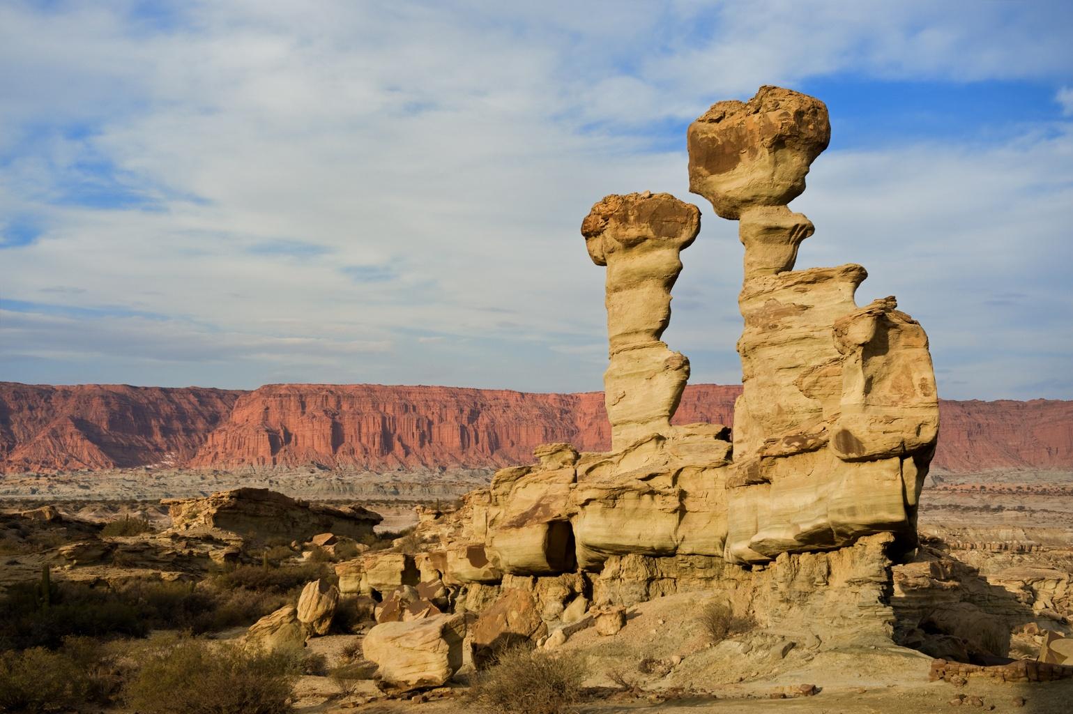
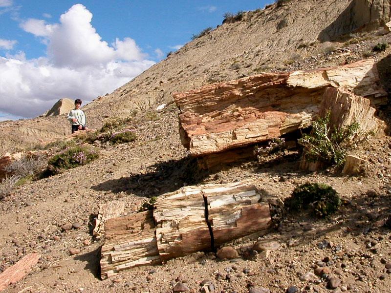
The Sarmiento Petrified Forest Natural Monument (Monumento Natural Bosque Petrificado Sarmiento) is a 24-hectare protected area in the southern centre of Chubut Province, Patagonia. The monument lies about 30 kilometres south of the town of Sarmiento, in a desert basin between the Andes and the Atlantic. The badland slopes here expose Paleocene-age volcaniclastic mudstone and tuff of the Salamanca and Río Chico formations, both of which contain permineralised trunks of southern conifers. The trunks range from small pole-sized stems up to 20-metre logs, all of them now silicified and lying scattered across the desert floor where erosion has stripped the softer matrix around them. The forest was identified in 1927 by Argentine paleobotanist Joaquín Frenguelli of the Universidad Nacional de La Plata, was opened as a provincial tourist attraction in 1970, and was designated a Natural Monument under provincial law in 1973. A guided interpretive trail loops about 2 kilometres around the most prominent log concentrations, with weather-proof panels that explain the geology and species. A small interpretation centre at the visitor area holds prepared samples and historical documentation. Collecting is prohibited. This guide covers how to reach the monument, what is visible along the trail, the Paleocene geology, and the rules that apply.
Location and Directions
Sarmiento sits in the southern centre of Chubut Province, about 150 kilometres west of Comodoro Rivadavia (the closest major coastal city and commercial airport) and 90 kilometres east of the Andes-front town of Río Mayo. From Comodoro Rivadavia, the drive takes about two hours on the paved RN-26.
The Natural Monument is reached from the town of Sarmiento by driving south on the Ruta Provincial 26 for about 12 kilometres of asphalt, then another 18 kilometres of gravel on Camino Interno 272. Total drive from Sarmiento is about 45 minutes in a passenger car. The road is dry-weather only and can become impassable after heavy rain or snow.
The visitor centre is at GPS 45.7517 degrees south, 68.9528 degrees west. Parking is gravel and free. Restrooms, a small interpretive centre, and the trailhead all sit at the visitor centre.
The standard adult entry fee is approximately 4,500 Argentine pesos at the time of writing, with reduced rates for students and Argentine residents. The monument is open year round, with extended hours from October through March (9 a.m. to 7 p.m.) and shorter hours from April through September (10 a.m. to 5 p.m.). Local Spanish-speaking guides are available at the visitor centre and accompany visitors on the 2-kilometre interpretive loop.
Sarmiento town has standard Argentine-budget hotels, restaurants, fuel, and a small museum dedicated to the local paleobotany. Comodoro Rivadavia, with the commercial airport, is the main full-service hub.
What Fossils You'll Find
You will not collect at Sarmiento Petrified Forest. What you can do is walk the 2-kilometre interpretive trail past in-place logs, root systems, and standing trunk bases. Identifications below follow the published Patagonian paleobotany literature and the visitor centre exhibit panels.
- Araucariaceae trunks. Permineralised Araucarioxylon-grade trunks dominate the assemblage, with some logs reaching 20 metres in length and 1.5 metres in diameter. The wood preserves growth rings, knot structure, and external bark texture.
- Podocarpaceae wood. Smaller-diameter permineralised wood referable to the southern podocarp family is present in lower numbers.
- Leaf compressions. Nothofagus and Araucaria leaf compressions are recorded from the same units in nearby outcrops outside the protected area.
- Pollen. The Salamanca Formation pollen record documents a mixed conifer-Nothofagus flora with abundant ferns, consistent with the macroflora at Sarmiento.
- Standing root systems. Several in-place root systems are exposed along the trail and indicate that the trees grew on the alluvial plain rather than being washed in from upstream.
The Sarmiento Museum (Museo Paleontológico Desiderio Torres) in town complements the in-place trail with prepared samples and a small mammal-fossil collection drawn from younger Patagonian units in the wider area.
Geologic History
The fossil-bearing rocks at Sarmiento belong to the Salamanca and overlying Río Chico formations, two units within the early Paleogene Patagonian stratigraphy. The Salamanca Formation is a marine-influenced unit deposited along the Atlantic coast of southern South America in the early Paleocene, immediately following the end-Cretaceous mass extinction. It is dated to roughly 65 to 63 million years ago by foraminiferal biostratigraphy and U-Pb ages on intercalated tuffs.
The overlying Río Chico Formation is a continental fluvial and lacustrine unit dated to roughly 63 to 55 million years ago, in the late Paleocene through early Eocene. Most of the petrified wood at the Sarmiento monument sits in the lower Río Chico Formation, in a sequence of volcaniclastic mudstone, tuff, and reworked ash. The trees grew on a wide alluvial plain east of the rising proto-Andes, in a humid subtropical to warm-temperate climate. Volcanic ash from arc volcanism to the west fertilised the floodplain soils and provided the silica that later replaced the wood.
Forest fires triggered by volcanic activity, followed by burial under ash and pyroclastic flow material, killed and buried whole trees. Silica-rich groundwater moving through the ash beds replaced the wood cell by cell, producing the cellular structure, growth rings, and original bark texture seen along the trail today.
After Paleogene deposition, the basin was buried by Neogene continental rocks, then exhumed during late Cenozoic Patagonian uplift. Modern wind and water erosion has stripped the softer overlying sediment and exposed the resistant silicified logs as scattered surface concentrations across the desert floor.
How Sarmiento Petrified Forest Became a Fossil Site
The petrified logs were known to Tehuelche communities long before European contact and were noticed by Welsh and Spanish settlers around the modern town of Sarmiento in the late nineteenth century. Joaquín Frenguelli of the Universidad Nacional de La Plata identified the locality as a major paleobotanical site in 1927 and published a series of monographs on the Patagonian Paleocene flora through the 1930s and 1940s. Modern stratigraphic and paleobotanical work has been led by María Gandolfo, Sergio Archangelsky, and Augusto Casamiquela.
The forest was opened to public tourism in 1970 under provincial management. The 1973 Natural Monument designation under Chubut provincial law formalised the protection. The visitor centre and interpretive trail were upgraded in 2010 with support from the Chubut tourism ministry.
Collecting Rules and Regulations
Collecting is prohibited. The Sarmiento Petrified Forest Natural Monument is administered by the Chubut Provincial Tourism and Protected Areas Authority under Chubut Provincial Law 1968 (Ley de Áreas Protegidas). Removing fossils, rocks, plants, or any material from the protected area is an offence under provincial law. The Argentine Federal Heritage Law 25743 also protects paleontological resources.
Practical rules:
- Stay on the marked interpretive trail. Stepping off the path to approach in-place trunks is not permitted.
- Photography for personal use is welcomed throughout the trail.
- A modest entry fee applies. Argentine seniors and students have reduced rates.
- Drones require advance written permission from the provincial protected areas authority.
- Pets are not allowed in the monument.
- Research collection is restricted to permitted teams working under Chubut Provincial and CONICET authorisation.
Safety
The Patagonian basin reaches 30 to 33 degrees Celsius in the summer (December through February), with strong winds throughout the year. Winter (June through August) brings overnight temperatures below freezing and occasional snow. The recommended visiting window is October through April.
Sun exposure at this latitude is intense, with the southern ozone hole producing high UV in spring. Carry high-SPF sun cover, a wide-brimmed hat, and at least 2 litres of water per person on the 2-kilometre trail. The trail has very little shade.
The wind in Patagonia can reach 80 kilometres per hour on exposed badland surfaces. Keep loose items secured.
The gravel access road can become impassable after heavy rain or snow. Check road conditions with the Sarmiento tourism office before driving.
Cell coverage is intermittent on the access road and absent on most of the trail. The visitor centre has a fixed-line phone for emergencies.
Sources
- Chubut Patagonia Government, "Protected Natural Area Sarmiento Petrified Forest." https://chubutpatagonia.gob.ar/en/destino/area-natural-protegida-bosque-petrificado-sarmiento/
- La Ruta Natural (Argentine national tourism), "Sarmiento Petrified Forest Protected Area." https://larutanatural.gob.ar/en/must-see/35/sarmiento-petrified-forest-protected-area
- Welcome Argentina, "Bosque Petrificado de Sarmiento." https://www.welcomeargentina.com/sarmiento/sarmiento-petrified-wood.html
- Frenguelli, J., 1934. "Floras del Gondwana en la Patagonia." Anales del Museo de La Plata, Buenos Aires.
- Brea, M. and Zucol, A.F., 2011. "The Paleogene South American Forests." Revista Brasileira de Paleontologia, 14.