Buffalo National River Crinoid Fossils Guide
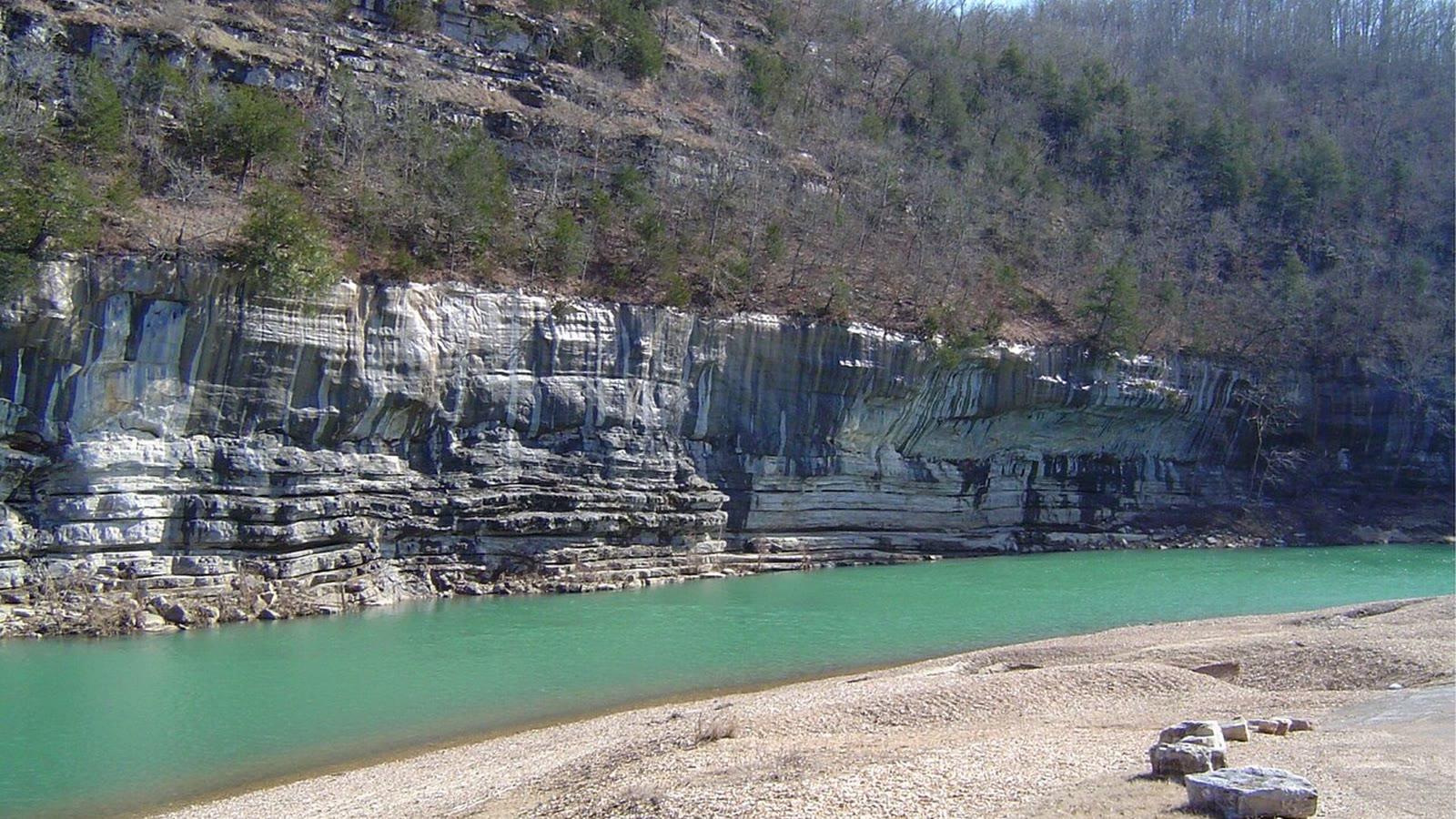
Image: National Park Service (Public domain (17 U.S.C. 105))
The bluffs and ledges along Buffalo National River in northern Arkansas cut through the Mississippian Boone Formation, where some limestone beds are roughly 90 percent crinoid debris. Collecting is illegal on National Park Service land, so this is a viewing and photography site.
By Edward Chen · Published 12 October 2026
Introduction
Some limestone beds inside Buffalo National River are about 90 percent crinoid material. That figure comes from the National Park Service itself, in a Fall 2018 Park Paleontology Newsletter article by Aliera Konett, a paleontology intern at the park. The same article reports that almost every stratigraphic unit along the river holds Paleozoic fossils, and names crinoids, brachiopods, bryozoans and occasional trilobites.
The park was established in 1972 and the river flows freely for 135 miles. Entry is free. The National Park Service states that there is no entry fee to enter the Buffalo National River area, or to use the river for recreation.
The catch is that none of it can be taken home. Collecting fossils inside a unit of the National Park System is a federal offence under 36 CFR 2.1. This page is written for a visitor who wants to look at Mississippian crinoid limestone in place, photograph it, and understand what the rock is.
Two park areas make that practical on foot. Tyler Bend and Buffalo Point both sit on mapped Boone Formation bedrock, both have a visitor contact point, and both have short marked trails off the parking lot.
 Photo: National Park Service, Public domain, via Wikimedia Commons
Location and Directions
Buffalo National River runs across northern Arkansas, in the Ozark Plateaus province, and reaches the White River at its eastern end. Do not treat the whole 135 miles as a single stop. Pick a developed river access.
Tyler Bend, Searcy County. GPS 35.9867°N, 92.7639°W, the figure the National Park Service publishes for the Tyler Bend campground. The area lies a few miles off US Highway 65 between St. Joe and Marshall. The visitor center, the campground and the trailheads are all here. The National Park Service lists the Riverview, Spring Hollow, Buck Ridge and Rock Wall Trails from the visitor center and campground area, about 4.5 miles in total, generally easy to moderate, with 250 to 300 feet of elevation change. Those trails connect to the Buffalo River Trail. The Riverview trailhead starts near the trail map at the visitor center.
Buffalo Point, Marion County. GPS 36.0854°N, 92.5657°W, again the park's own campground figure. The Indian Rockhouse Trail starts from a parking lot about half a mile east of the Buffalo Point Ranger Station. The National Park Service describes it as 3.5 miles round trip, moderate to strenuous, with steep inclines and declines, and allows 3 to 5 hours. The route passes a sinkhole, a waterfall, a mine prospect, Panther Creek, sculpted bedrock and a quarry. Pets are not permitted on that trail.
The United States Geological Survey State Geologic Map Compilation maps both points as Boone Formation with the St. Joe Limestone Member. That is the practical reason to start at these two areas rather than upstream.
Upstream at Steel Creek, by contrast, the same compilation maps the river-level rock as Everton Formation, which is Ordovician. The Arkansas Geological Survey float guide for the Ponca reach agrees, and places St. Joe and Boone rock only at the top of the bluff, high above the water.
Camping fees apply at the developed campgrounds. The park charged 20 dollars per site per night at Tyler Bend individual sites and 30 dollars per site per night in the main Buffalo Point loops when this page was written. Check current rates before you travel.
What Fossils You'll Find
Nothing here is collectable. What follows is what you can identify in place.
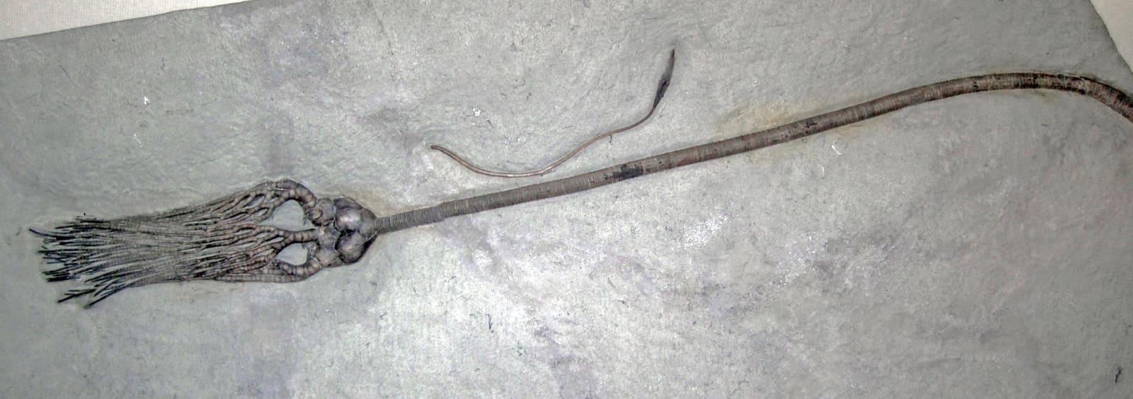
Crinoid columnals are the signature of this rock. The Arkansas Geological Survey states plainly that crinoids are the most common fossil found in the Boone Formation, and lists brachiopods, bryozoa, molluscs, corals, shark material, trilobites and conodonts alongside them. Look for the circular or star-sectioned stem discs, often stacked in short lengths, weathering out of the limestone surface.
Be ready for disarticulated material rather than whole animals. George Girty's 1915 United States Geological Survey monograph on the Boone limestone fauna at St. Joe, Arkansas, records that crinoidal remains are common and that some layers consist of little else. He describes circular stem segments, few of which exceed 15 millimetres in diameter. He also notes that a few specimens are possibly basal plates of some species of Platycrinus, and states elsewhere in the same work that no determinable crinoids had yet been found in the St. Joe limestone.
That is worth sitting with. The park is full of crinoid rock and nearly empty of named crinoids.
The brachiopods are better resolved. Girty recorded Spirifer grimesi Hall and Chonetes illinoisensis Worthen from the St. Joe limestone member at St. Joe, Arkansas, the village that sits beside the Tyler Bend turnoff. He recorded Rhynchopora pinguis from the lower part of the Boone limestone at the same place, and Schizophoria swallowi from beds overlying the St. Joe member. Tabulate corals of the family Syringoporidae occur in the Boone limestone elsewhere in Arkansas.
The National Park Service article adds two park specialities outside the Boone. Nautiloids occur in the bluffs and are visible from the river. Skolithos worm burrows occur in the Ordovician units, most notably in the St. Peter Sandstone.
 Photo: Ryan Shell, CC BY-SA 3.0, via Wikimedia Commons
Geologic History
The Boone Formation is Early and Middle Mississippian. The Arkansas Geological Survey describes it as gray, fine to coarse-grained fossiliferous limestone interbedded with chert, with dark cherts low in the sequence and light cherts higher up. Thickness runs 300 to 350 feet across most of northern Arkansas, and as much as 390 feet has been reported. The chert content varies a great deal both vertically and laterally, which is why some outcrops look like clean limestone and others look like rubble.
The St. Joe Limestone Member sits at the base. The Arkansas Geological Survey calls it a fine-grained, crinoidal limestone that may contain some smoothly bedded chert, ranging from a feather edge to over 110 feet thick. Crinoids, brachiopods, bryozoa, conodonts, blastoids, ostracods and rugose coral are recorded from it.
The limestone formed on a shallow marine shelf. Crinoids lived attached to that seafloor in large numbers, and their stems broke into stacked discs after death. Where currents swept the debris into banks, the result is a rock made almost entirely of crinoid skeleton, which is the 90 percent figure the park reports.
A long gap sits under the Mississippian rock. The Arkansas Geological Survey float guide notes that sediment probably did accumulate here during the Silurian and Devonian, then uplift and erosion removed it before Mississippian time. That unconformity is visible on Big Bluff in the Ponca Wilderness, where the Goat Trail runs along a recess cut in the basal St. Joe Limestone. The same guide records that the St. Joe limestones there carry small fossil fragments, mostly crinoids and bryozoa, and that cherty Boone Formation beds cap the bluff above.
Red colouring in parts of the St. Joe is a local marker. The Arkansas Geological Survey attributes the brick-red tint to trace amounts of iron oxide.
The Buffalo River has since cut deeply into this stack. The National Park Service records tall vertical bluffs standing at river bends as the result.
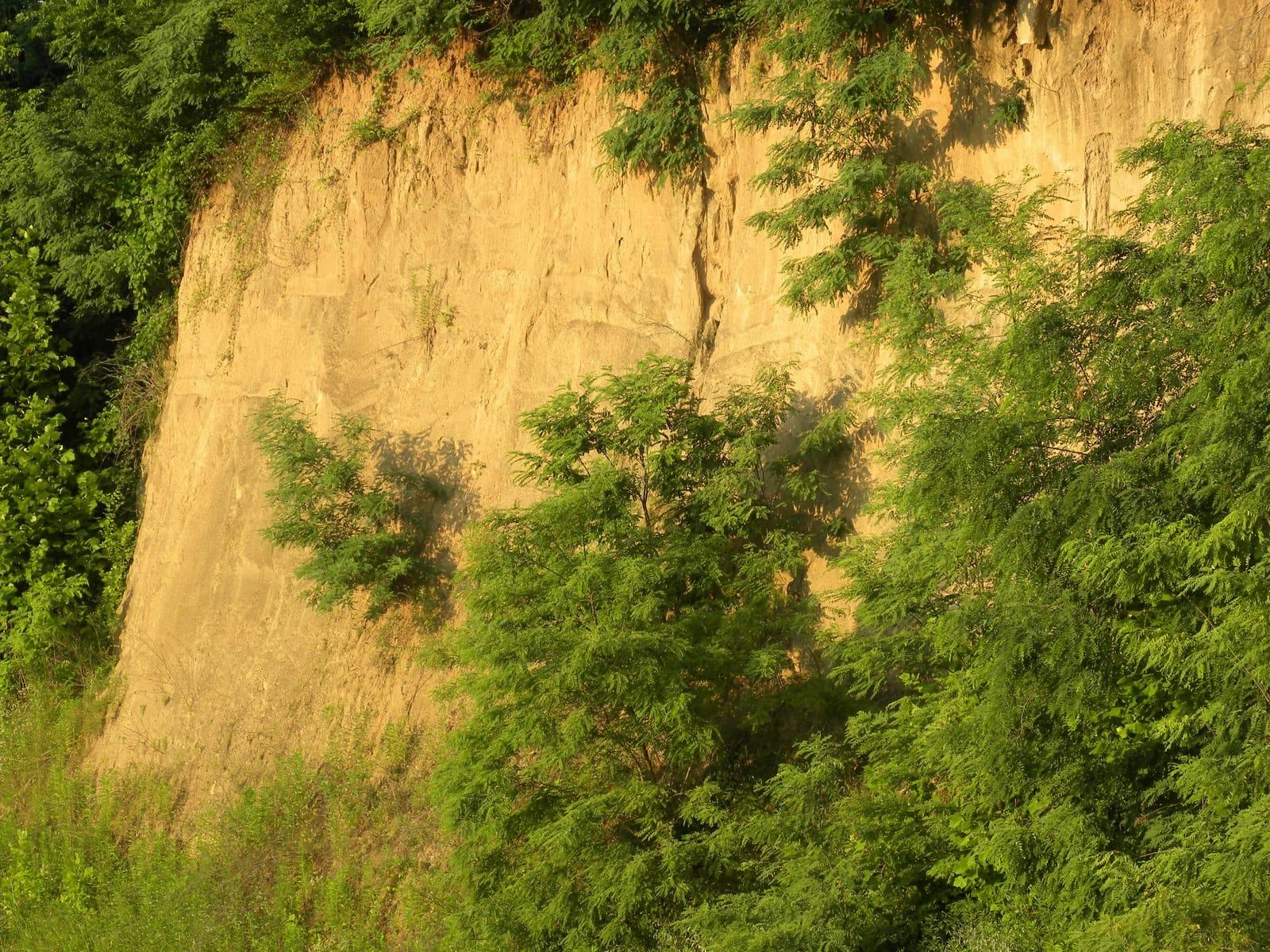
 The same Boone Formation about 100 km northwest of the park, in a roadcut beside Interstate 49 near the Arkansas and Missouri state line. This exposure is not inside Buffalo National River. Photo: YodellingFish, CC BY-SA 4.0, via Wikimedia Commons
Collecting Rules and Regulations
Do not collect any fossil here. It is a federal offence.
Buffalo National River is a unit of the National Park System. Title 36 of the Code of Federal Regulations, section 2.1(a)(1), prohibits possessing, destroying, injuring, defacing, removing, digging or disturbing from its natural state "nonfossilized and fossilized paleontological specimens, cultural or archeological resources, or the parts thereof". Subsection (a)(1)(iv) covers a mineral resource or cave formation or the parts thereof.
The National Park Service repeats this in its own guidance on paleontology legal instruments, which cites 36 CFR 2.1(a)(1)(iii) as prohibiting the destruction, injury, defacing, removal, digging or disturbance of paleontological specimens or their parts. The Paleontological Resources Preservation Act of 2009 sits above the regulation and provides for the management and protection of paleontological resources on federal land.
What this means in practice:
- Look, photograph and record. Do not hammer, pry, dig or pocket.
- The prohibition covers loose material on a gravel bar as well as rock in a bluff. Removal from its natural state is the test, not whether the specimen was attached.
- The Indian Rockhouse bluff shelter at Buffalo Point has been protected from all excavation and collection since 1972, when it became part of the park. Treat the whole park the same way.
- Scientific collecting happens only under a National Park Service research and collecting permit.
- There is no entry fee, so there is no permit to buy at the gate. Entry and collecting are separate questions.
If you want to collect Boone Formation material legally, the place to ask is a private landowner or a commercial quarry outside the park boundary, with written permission. The Arkansas Geological Survey publishes general guidance on fossil collecting in the state.
Safety
Bluff edges here are high and unfenced. Stay back from the lip. Big Bluff stands over 500 feet tall and is reported to be the highest bluff on the Buffalo. The Arkansas Geological Survey describes the Goat Trail approach as steep and slippery and often near the edge of the bluff, and advises against the climb for anyone uneasy with heights or rough ground.
The river rises fast. Floating conditions change with rainfall. Call the park for water levels before a float trip rather than judging from the put-in. The Arkansas Geological Survey rates the Ponca to Kyles Landing reach class I to II whitewater with frequent rapids and a drop of about 12 feet per mile, and notes that a high proportion of floaters capsize. Carry dry clothes.
Loose chert and wet limestone. The Boone weathers to angular chert rubble on slopes, and it moves under a boot. Wet limestone ledges are slick. Wear boots with a real sole and keep hands free on steep ground.
Ticks, chiggers and snakes. Northern Arkansas has all three through the warm months. Long trousers, repellent and a check afterwards are sensible. Copperheads and timber rattlesnakes occur in the Ozarks, so watch where you put hands on ledges and in leaf litter.
Caves and sinkholes. The park is karst country, and the Indian Rockhouse Trail passes a sinkhole and a mine prospect. Do not enter cave openings. Some are closed to protect bats, and all of them are hazardous without equipment and training.
Mobile coverage is patchy through the valley. Tell someone your route, carry water, and plan on 3 to 5 hours for the Indian Rockhouse Trail rather than the map distance.
Sources
https://www.nps.gov/articles/park-paleo-fall-2018-fossil-record.htm https://geology.arkansas.gov/geology/ozark-plateaus-region-mississippian-period.html https://www.geology.arkansas.gov/docs/pdf/geology/general_geology/brfguide.pdf https://pubs.usgs.gov/bul/0598/report.pdf https://www.law.cornell.edu/cfr/text/36/2.1 https://www.nps.gov/articles/paleontolosy-legal-instruments.htm https://www.nps.gov/buff/planyourvisit/camping.htm https://www.nps.gov/buff/planyourvisit/fees.htm https://www.nps.gov/thingstodo/hike-tyler-bend-trails.htm https://www.nps.gov/thingstodo/hike-the-indian-rockhouse-trail.htm https://home.nps.gov/buff/learn/nature/climate-and-geology.htm https://ngmdb.usgs.gov/Geolex/Units/Boone_7274.html
.jpg)

