Dalle aux Ammonites, Digne-les-Bains Fossil Hunting Guide
Image: Desoxyribose (CC BY-SA 3.0)
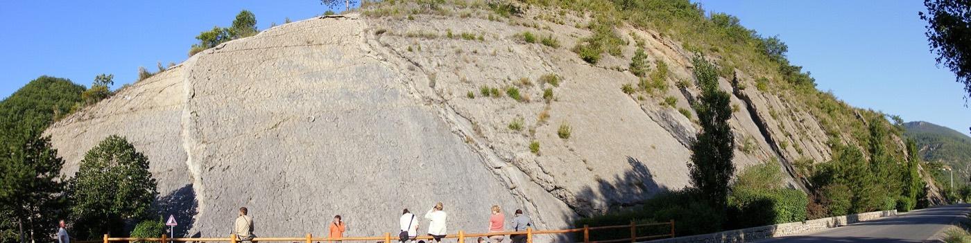
A grey limestone bedding plane tilted to 60 degrees beside the Barles road north of Digne-les-Bains carries more than 1,550 Early Jurassic cephalopods across roughly 320 square metres. Most are the ammonite Coroniceras multicostatum and the largest reach 70 centimetres across. Access is free all year and the slab is protected, so nothing may be collected.
By Edward Chen · Published 11 September 2026
Introduction
The Dalle aux Ammonites is a single bedding plane, and everything that makes it worth the trip is on that one surface. More than 1,550 cephalopods lie exposed across about 320 square metres of grey limestone. Most are ammonites. A smaller number are nautiloids. The largest shells measure about 70 centimetres in diameter, which is wide enough to read from the viewing area without optics.
One species dominates: Coroniceras multicostatum. That consistency is part of the scientific interest. It points to a single event, or to a narrow window of accumulation, rather than to a slow rain of shells over a long period.
The slab now stands at about 60 degrees from horizontal. It was flat when the animals settled onto it. Alpine collision tilted the seafloor into the position you see, which makes the site a demonstration of two subjects at once, palaeontology and mountain building.
The site sits inside the Réserve Naturelle Géologique de Haute-Provence and is protected. This is a place to look at, not a place to collect from.
The concentration itself is the question the slab poses. A normal seafloor accumulates shells slowly and scatters them at every angle. This surface carries more than 1,550 in one plane, lying flat and overwhelmingly of one species. That pattern points to a mass death or a current that gathered floating shells and dropped them together, rather than to ordinary background sedimentation.
Location and Directions
The slab is on the D900A, the Barles road, about 3 kilometres north of the centre of Digne-les-Bains. It is visible from the roadside, and there is a pull-in with an interpretation panel.
GPS: 44.1194°N, 6.2342°E.
Access is free and available all year. No booking is needed, and there is no gate or opening time. The site is one of 18 protected geological sites in the Réserve Naturelle Géologique de Haute-Provence. Those 18 sites total about 270 hectares, inside a protection perimeter of roughly 230,000 hectares across 59 communes.
Digne-les-Bains is the nearest town for parking, fuel and food. The Musée Promenade at Saint-Benoît sits on the northern edge of town. It is the reserve's own interpretation centre, and it is the sensible first stop for geological context.
What Fossils You'll Find
You will not find anything, in the collecting sense, and that is the point of the site. What you will see is the following.
Coroniceras multicostatum is the dominant ammonite and accounts for the great majority of the shells on the surface. It is a ribbed, evolute form, which means the coils are loosely wound and each whorl leaves the previous one visible. On the slab this reads as a clear spiral of ribs even at a distance.
Nautiloids occur in smaller numbers. They are smooth-shelled and less tightly ornamented than the ammonites, so they stand out once you know to look for them.
The shells lie flat on the bedding plane rather than scattered through the rock. That orientation is what allows so many to be visible at once.
 Photo: Zairon, CC BY 4.0, via Wikimedia Commons
Geologic History
The limestone formed in the Sinemurian, the second stage of the Early Jurassic, roughly 200 to 196 million years ago. At that time the region lay under a sea, and the surface you see was the seafloor.
The Alps did not exist yet. The collision between the African and European plates came much later. It crushed, displaced, tilted and raised this seafloor into the mountain front above Digne. The 60 degree dip of the slab is a direct record of that movement.
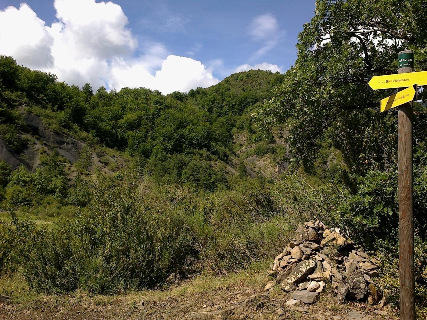
The surrounding country rock belongs to the same Jurassic marine succession. The reserve protects a series of sites through it. They run from ammonite beds like this one to the ichthyosaur at La Robine and the sirenian localities further south.
Ammonites float after death, because the chambered part of the shell holds gas. A drifting shell can travel a long way from where the animal lived before it waterlogs and sinks. That is the standard caution with any ammonite bed. It applies here: the slab records where the shells came to rest, which is not necessarily where the animals swam.
 Photo: J. Lombardo, CC BY-SA 3.0, via Wikimedia Commons
Collecting Rules and Regulations
Collecting is prohibited. The slab is a protected site inside a réserve naturelle géologique, and in that designation fossils stay where they lie. Authorisation to collect exists, but it is granted for research and is not available to visitors.
Do not hammer, chisel, lever or scrape the surface. Do not take loose fragments from the base of the slab.
The same rule applies across the reserve's other protected sites. To collect in France, go to the open coast and follow the local prefectoral orders. Do not collect inside a geological reserve.
 Photo: Zairon, CC BY 4.0, via Wikimedia Commons
Safety
The site is beside a road. Park in the designated pull-in and keep off the carriageway, because the D900A carries traffic at speed and sight lines on the approach are limited.
The slab itself is steep. Do not climb on it. The surface is smooth limestone and it is slippery when wet.
In winter the Barles road can carry ice and snow. Check conditions before you drive up from Digne.
 Photo: Nicolas Eynaud, CC BY-SA 4.0, via Wikimedia Commons
Sources
https://iugs-geoheritage.org/geoheritage_sites/the-ammonite-slab-of-digne-les-bains/ https://www.dignelesbains-tourisme.com/decouvrir/les-incontournables/la-dalle-aux-ammonites/ https://www.lithotheque.ac-aix-marseille.fr/Affleurements_PACA/04_digne_isnards/04_digne_isnards_index.htm https://www.geoparchauteprovence.com/en/


.png)