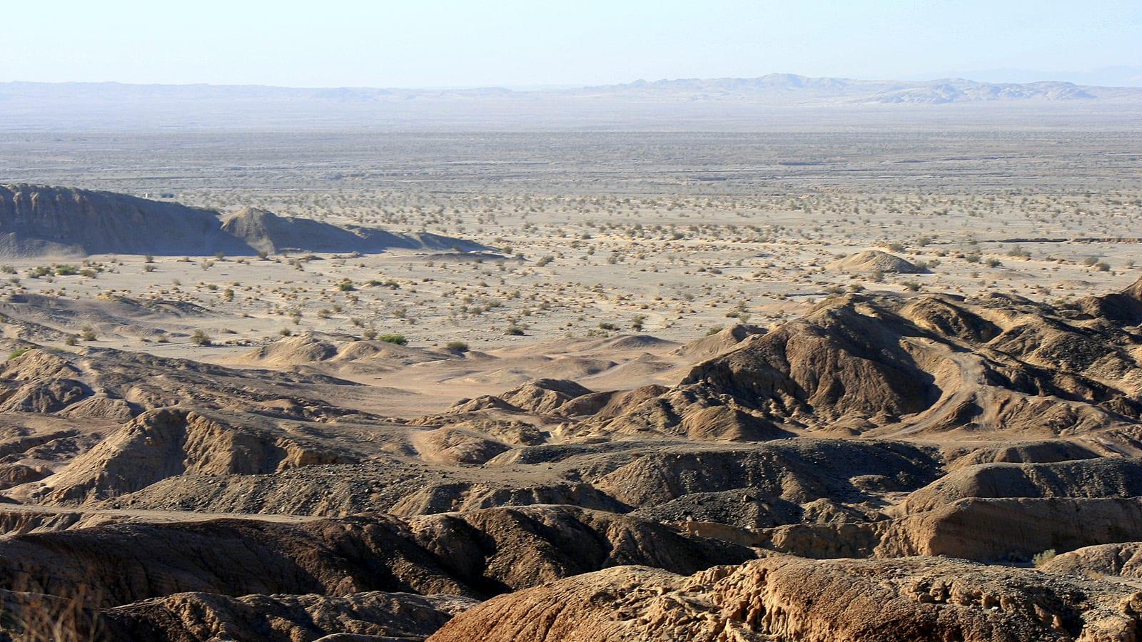
Fossil Canyon near Ocotillo Fossil Hunting Guide
Image: Patty Mullins (CC BY 2.0)
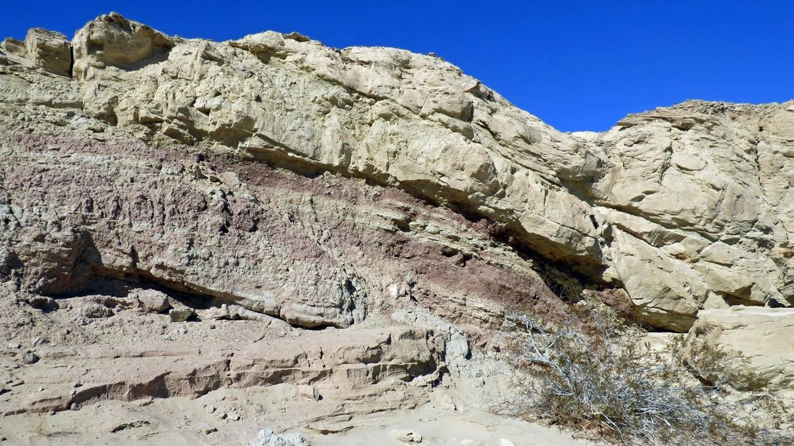
Fossil Canyon in the Coyote Mountains above Ocotillo cuts through the Pliocene Imperial Formation, exposing oyster reefs, corals, sand dollars, and marine shells from a warm sea that reached this desert about 6 to 4 million years ago. The canyon lies inside Anza-Borrego Desert State Park, so it is a viewing site.
By Edward Chen · Updated 11 July 2026
Introduction
Fossil Canyon in the Coyote Mountains, above the small community of Ocotillo in Imperial County, cuts through the marine beds of the Pliocene Imperial Formation. The canyon walls preserve oyster reefs, corals, sand dollars, and marine snails from a warm sea that flooded this corner of the Colorado Desert between about 6.3 and 4.3 million years ago.
The desert here once formed the northern arm of a marine gulf linked to the ancestral Gulf of California. Some of the corals in these beds have Caribbean and Atlantic affinities, carried west into the Pacific side before the Isthmus of Panama closed, which is part of what makes the exposure of interest to geologists. The canyon sits inside the Coyote Mountains part of Anza-Borrego Desert State Park, so it is best treated as a place to view and photograph fossils in the rock rather than to collect them.
Location and Directions
Ocotillo lies along Interstate 8 roughly 90 miles east of San Diego and 30 miles west of El Centro, near 32.74°N, 115.99°W. From the Ocotillo exit, local desert roads lead north and west toward the mouth of Fossil Canyon in the Coyote Mountains. The final approach is unpaved, sandy, and rough, so a high-clearance vehicle is a good idea and four-wheel drive helps after storms.
There are no facilities at the canyon. The nearest fuel, water, and food are in Ocotillo itself, and you should fill up and carry everything you need before leaving the highway. Cell coverage in the canyon is unreliable.
What Fossils You'll Find
The Imperial Formation beds exposed in the canyon are packed with shallow-marine invertebrates.
Bivalves are the most obvious finds. Thick-shelled oysters weather out of the mudstone in dense lenses that geologists call oyster reefs, and scallops and other clams appear alongside them. Gastropods, the coiled marine snails, are common in the finer beds. Corals occur as pale colonial heads, including forms with Atlantic and Caribbean relatives rather than Pacific ones. Echinoids include sand dollars, whose flat, round tests show up as chalky disks in the sandstone. Inarticulate brachiopods of the genus Glottidia have also been recorded from these beds.
Look along freshly eroded walls and in the loose material at the base of the slopes, where weathering concentrates the harder shells. Wet rock and low-angle morning or evening light make the fossils far easier to pick out.
Geologic History
The Imperial Formation records a marine incursion around 6.3 to 4.3 million years ago, when the proto-Gulf of California reached north into the Salton Trough. Warm, shallow water supported oyster banks, coral patches, and a diverse shelly fauna. As the Colorado River built its delta across the trough, it eventually cut this inland sea off from the ocean, and the marine beds were buried by the terrestrial sands and muds of the overlying Palm Spring Formation.
Later movement along the faults that border the Coyote Mountains lifted and tilted the whole sequence, so that streams like the one that carved Fossil Canyon now expose the old seafloor in cross-section.
Collecting Rules and Regulations
Fossil Canyon lies within Anza-Borrego Desert State Park. Collecting any natural feature, including fossils, rocks, and plants, is prohibited in California state parks, so this is a viewing and photography site only. Enjoy the fossils where they sit, and do not hammer, pry, or remove material.
Some land bordering the Coyote Mountains is federal Bureau of Land Management wilderness, where different rules apply and where wilderness and vehicle restrictions are strict. Boundaries on the ground are not obvious, so unless you have confirmed you are on land that permits it, treat the entire canyon as no-collecting.
Safety
This is low desert, and summer heat is the main danger. Plan visits for the cooler months between October and April, carry far more water than you expect to drink, and start early. There is no shade or water in the canyon.
Flash floods can fill the narrow washes quickly during rain, so watch the weather and stay out of the canyon bottom when storms threaten. The access roads are sandy and remote, and vehicles do get stuck. Watch for rattlesnakes, and for the spines of ocotillo, cholla, and other desert plants. Tell someone your plans before you go, since help is far away and phones may not work.
Sources
https://www.sdnhm.org/download_file/view/5186/660/ https://pubs.usgs.gov/of/1993/0562/report.pdf https://nrm.dfg.ca.gov/FileHandler.ashx?DocumentID=8668 https://www.parks.ca.gov/?page_id=638