Marine Fossils near Coalinga Fossil Hunting Guide
Image: Missvain (CC BY 4.0)
The Diablo Range foothills around Coalinga expose the shallow-marine Miocene Temblor Formation, which yields sand dollars, clams, snails, and coral from a warm sea of about 17 to 14 million years ago. The beds are spread across a mix of public and private ranch land, so land ownership governs where you can hunt.
By Edward Chen · Updated 1 August 2026
Introduction
The foothills of the Diablo Range around Coalinga, on the western edge of the San Joaquin Valley, expose a thick stack of marine rock. Within it, the shallow-marine Miocene Temblor Formation yields the sand dollars, clams, snails, and coral that draw fossil hunters to the arroyos and washes south and west of town.
These beds formed in a warm, shallow sea that covered the area between roughly 17 and 14 million years ago. The same formation is famous a little to the south at Shark Tooth Hill, where its Round Mountain Silt member has produced marine mammal bones and shark teeth. Around Coalinga the more common finds are invertebrates, and the ground is a patchwork of public and private ranch land, so where you can legally hunt depends entirely on who owns the parcel.
Photo: Smithsonian National Museum of Natural History, CC0, via Smithsonian Open Access
Location and Directions
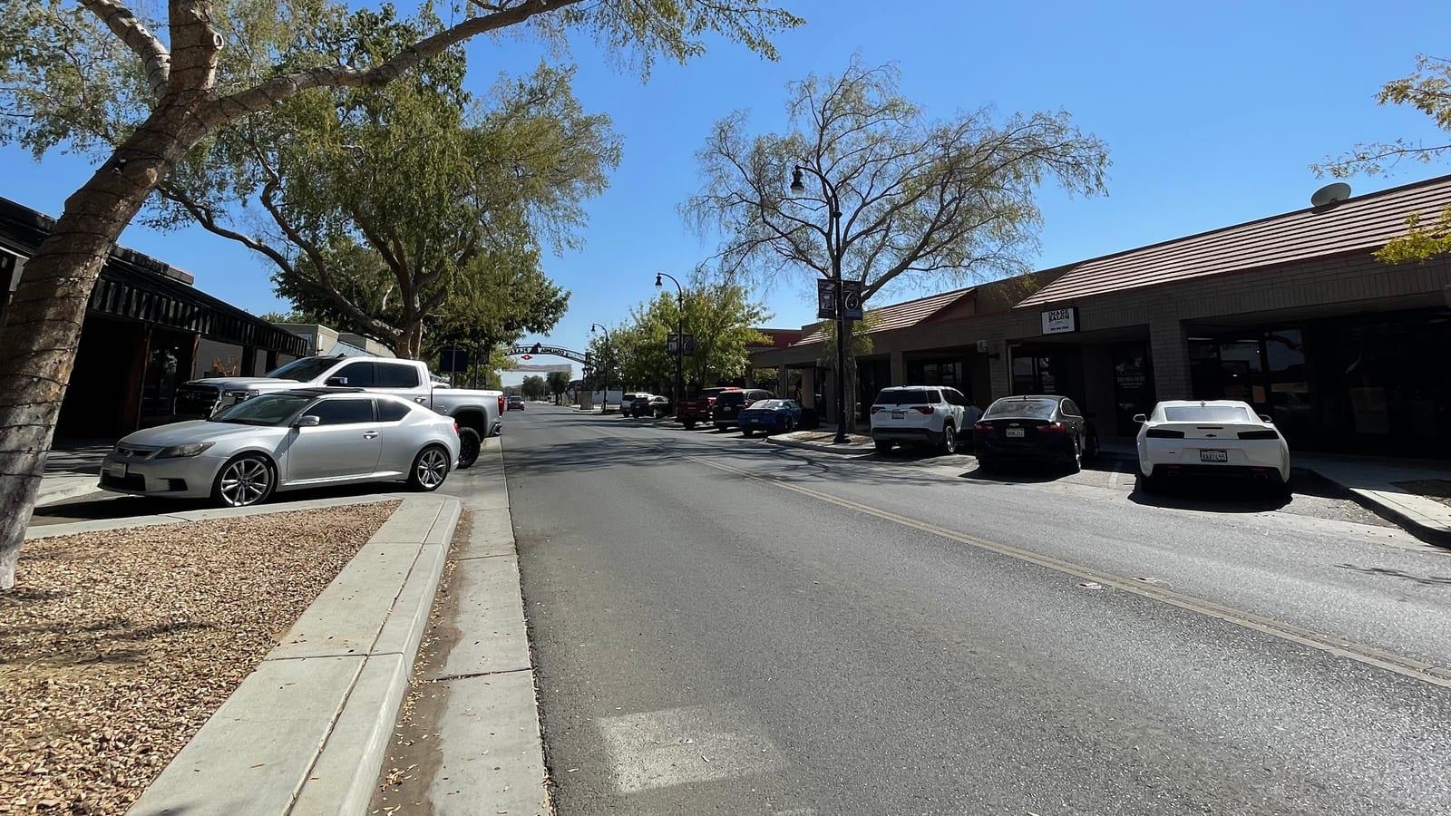
Coalinga sits in western Fresno County, reached from Interstate 5 by State Route 198, near 36.14°N, 120.36°W. The fossil-bearing exposures lie in the low hills of the Diablo Range to the south and west, cut by dry arroyos and road banks. There is no single marked fossil park. The town has fuel, food, and lodging, and you should carry water and supplies before heading into the hills, where services and cell coverage drop off quickly.
 Photo: Missvain, CC BY 4.0, via Wikimedia Commons

What Fossils You'll Find
The Temblor Formation here preserves a shallow-marine invertebrate fauna.
Sand dollars are the signature find, appearing as flat, round echinoid tests weathering from the sandstone. Bivalves, including scallops and other clams, are common, and gastropods, the marine snails, turn up alongside them. Corals occur as small colonial or solitary forms from the warm Miocene water.
Concentrate on freshly cut banks and the gravelly floors of washes, where runoff has already loosened and concentrated the harder fossils. A spray bottle of water brings out detail, and low-angle light makes shells easier to see against the pale rock.
Geologic History
During the early to middle Miocene, a shallow sea reached into a series of fault-bounded basins along what is now the Diablo Range. The Temblor Formation records that sea, with facies ranging from estuary and shoreline sands to deeper subtidal and diatomite beds. Its shallow shoreline sands are where sand dollars and shelly invertebrates accumulated.
Beneath the Temblor lie older Eocene marine formations such as the Kreyenhagen, and the whole sequence was later folded and lifted along the faults of the Coalinga anticline. Erosion of those folds is what now exposes the marine beds at the surface in the surrounding hills.
Collecting Rules and Regulations
Land ownership is the first thing to sort out here, because the exposures cross private ranches, oil-lease land, and scattered Bureau of Land Management parcels. On private land you must have the owner's permission before entering or collecting, and much of the ground around Coalinga is fenced and posted. Trespassing is illegal and, near working oil and ranch operations, dangerous.
On BLM land, casual collecting of reasonable amounts of common invertebrate fossils such as sand dollars and shells for personal use is generally allowed, but vertebrate fossils are protected and may not be collected without a permit. Because parcel boundaries are not obvious on the ground, confirm the land status before you collect, and when you are unsure, treat the site as no-collecting.
Safety
This is remote, dry country. Summers are extremely hot, so plan trips for the cooler months and carry plenty of water. The dirt roads are rough and become impassable when wet, and washes can flood during storms. Watch for rattlesnakes on warm slopes, and keep clear of active oil-field and ranch equipment and any posted hazard areas. Tell someone your route before you go, since help is far off and phones often do not work.
Sources
https://pubs.usgs.gov/pp/0205c/report.pdf http://www.sjvgeology.org/geology/fossil-bones-shells.html https://pubs.usgs.gov/publication/oc1
Nearby sites
 Jacalitos Creek Fossil Hunting GuideBivalves, Gastropods
 Shell Creek Fossil Hunting GuideClams (Protothaca staleyi), Oysters (Crassostrea)
 Oyster Fossils at Santa Margarita Ranch, San Luis Obispo CountyOysters (Crassostrea titan), Bivalves
 Moonstone Beach, Cambria Fossil Hunting GuideBivalves, Sand Dollars